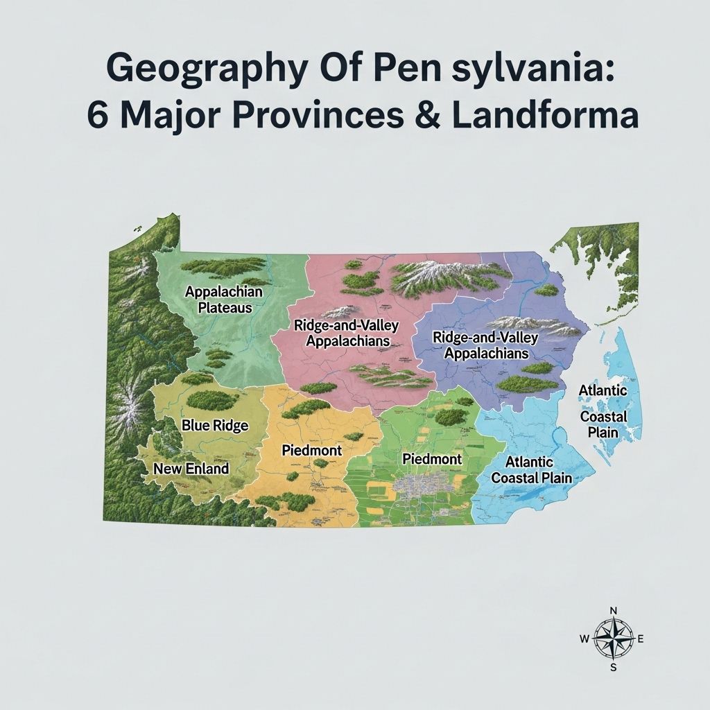
Geography Of Pennsylvania: 6 Major Provinces & Landforms
A deep dive into the diverse landscapes and geological wonders that define Pennsylvania’s natural beauty.

Image: HearthJunction Design Team
Pennsylvania’s Varied Terrain: An Introduction
Pennsylvania is a land shaped by ancient geologic forces and rich natural diversity. Its landscape weaves together rugged mountains, dissected plateaus, rolling valleys, and fertile plains—each with a unique story that influences the state’s ecology, culture, and history. Whether you’re exploring the dramatic vistas of the Appalachian Mountains, the undulating hills of the Piedmont, or the scenic river gorges, Pennsylvania’s topography is a testament to millions of years of geological evolution and natural artistry.
Major Physiographic Provinces of Pennsylvania
The state’s landscape can be divided into several distinct regions, often referred to as physiographic provinces. Each province features its own geology, landforms, and natural resources. Understanding these regions provides a foundation for exploring the state’s terrain:
- Atlantic Coastal Plain
- Piedmont
- New England Province
- Ridge and Valley
- Appalachian Plateau
- Central Lowlands
Let’s take a closer look at the dominant features and characteristics of these provinces and some of the most iconic places they encompass.
The Appalachian Mountains: Pennsylvania’s Backbone
Pennsylvania is bisected in a dramatic S-curve by the vast ridges of the Appalachian Mountains, running southwest to northeast across the state. This mountain chain is not only a physical barrier but also a historical one, shaping early travel routes, settlement patterns, and industry. The ridges and valleys formed by the Appalachian Mountains are especially noticeable in central Pennsylvania, where steep, forested crests alternate with broad, fertile valleys.
The Ridge-and-Valley Appalachians
This region, running diagonally across central Pennsylvania, features tightly packed parallel ridges and elongated valleys. The rocks here are intensely folded, resulting in dramatic landscape patterns and complex geology. The Ridge-and-Valley Province is well known for:
- Chaotic geology: Intense folding and thrust faulting create a maze of anticlines, synclines, and faults.
- Distinct landforms: Steep ridges with broad, fertile valleys in between.
- Rich anthracite fields: The world’s largest deposits of high energy, clean-burning anthracite coal, critical to the American Industrial Revolution.
Subregions of the Ridge-and-Valley Province
This province contains several distinct areas, each characterized by unique features and geologic materials:
South Mountain
As the northernmost extension of the Blue Ridge Mountains, South Mountain is defined by broad ridges and deep, narrow valleys. Its rocks—highly metamorphosed igneous and sedimentary types—date back to the Pre-Cambrian era, making them among the oldest in Pennsylvania. South Mountain’s elevation and ruggedness have fostered extensive forests, making it a haven for outdoor enthusiasts and wildlife.
Great Valley
The Great Appalachian Valley stretches from Canada to Alabama and forms a significant regional corridor. In Pennsylvania, it is subdivided into the Lehigh, Lebanon, and Cumberland Valleys, each known for:
- Diverse bedrock: Limestone, dolomite, slate, shale, sandstone, siltstone, and basalt.
- Economic value: Extensive quarrying of limestone and dolomite for cement, fertilizers, and mine dust control.
- Karst features: Sinkholes and caverns resulting from the dissolution of carbonate rocks, often posing challenges for development.
The Allegheny Plateau: Elevated Wilds
To the northwest of the folded mountains, the Allegheny Plateau rises above the dramatic Allegheny Front escarpment. This province is characterized by:
- Dissected plateaus: Broad, elevated expanses incised by valleys and streams, creating local relief of several hundred feet.
- Ancient sedimentary rocks: Mainly Mississippian and Pennsylvanian in age, containing abundant fossils and significant mineral resources such as coal, iron, natural gas, and petroleum.
- Natural beauty: Home to the Pennsylvania Wilds, Allegheny National Forest, Pine Creek Gorge (the “Grand Canyon of Pennsylvania”), and Cook Forest, known for pristine wilderness and old-growth trees.
The plateau’s resources powered early industries and continue to shape the region’s economy and culture.
Other Significant Landforms and Regions
Piedmont Province
Bordering the Ridge-and-Valley to the southeast, the Piedmont features gently rolling hills, fertile soils, and an agricultural landscape. Its underlying rocks include schist, gneiss, and various metamorphic types, contributing to the region’s productive farmland and scenic vistas.
Atlantic Coastal Plain
Occupying a small area in the extreme southeastern corner (including Philadelphia), the Coastal Plain is a relatively flat, low-lying area shaped by river systems and past marine influences. Rich soils and easy river access have long made this region a hub for trade and settlement.
New England Province
The northeastern tip of Pennsylvania shares characteristics with the greater New England region: glaciated landscapes, rugged hills, and a mix of forests and lakes.
Iconic Pennsylvania Geologic Features
From ancient rocks to dramatic natural formations, Pennsylvania boasts dozens of notable geologic landmarks. Some of the most celebrated include:
- Presque Isle: A sandy peninsula arching into Lake Erie, renowned for its beaches and unique ecosystems.
- Bilger’s Rocks: A massive outcrop of sandstone boulders, riddled with passageways and eroded by centuries of wind and water.
- Canyon Vista & Pine Creek Gorge: Pine Creek Gorge, often called the “Grand Canyon of Pennsylvania,” offers breathtaking views and deep, forested chasms.
- Hyner View: A spectacular overlook above the West Branch Susquehanna River, popular with hang gliders and hikers.
- Lehigh Gorge: Steep-sided river valley, home to waterfalls, scenic views, and popular recreation trails.
How Pennsylvania’s Terrain Shaped History and Culture
The state’s dramatic landscape has guided the course of its history. Early travel routes often followed natural corridors, such as ancient Indian paths, river valleys, or breaks in the mountain ridges known as water gaps. The Susquehanna River and its tributaries provided key links through the central valleys and once carried the Pennsylvania Canal System, fostering trade and settlement. The valleys and lowlands supported farming, while the plateaus and mountains powered early extractive industries—coal, lumber, and iron.
Today, this varied topography supports a wealth of outdoor recreation—from hiking and fishing to leaf-peeping and wildlife watching—while its rich natural resources remain vital to Pennsylvania’s economy and identity.
Geologic Timeline: Pennsylvania’s Foundations
| Era | Key Events & Features |
|---|---|
| Pre-Cambrian | Formation of South Mountain’s ancient metamorphic rocks |
| Ordovician | Deposition of limestone, dolomite, and other carbonates in the Great Valley |
| Mississippian & Pennsylvanian | Development of Allegheny Plateau’s coal-bearing rocks |
| Pleistocene | Glaciations shaping the northeastern and northwestern landscapes |
Frequently Asked Questions (FAQs)
What are Pennsylvania’s most prominent landforms?
Pennsylvania’s landscape is dominated by the Ridge-and-Valley Appalachians, the Allegheny Plateau, the Piedmont, and the Atlantic Coastal Plain. Ridges, valleys, plateaus, and river gorges offer diverse natural scenery and habitats.
How did the Appalachian Mountains form?
The Appalachian Mountains were created over hundreds of millions of years through the collision of continental plates—a process known as orogeny. In Pennsylvania, the Alleghenian orogeny resulted in intense folding and faulting of rocks, producing today’s dramatic ridges and valleys.
What is the significance of the anthracite coal fields?
Pennsylvania’s anthracite coal fields, primarily in the Ridge-and-Valley region, are the world’s largest deposits of this high-energy, clean-burning coal. They fueled the state’s industrial growth and the broader American Industrial Revolution.
Why are there so many sinkholes in southeastern Pennsylvania?
Southeastern Pennsylvania, especially the Great Valley, is underlain by carbonate rocks like limestone and dolomite. As acidic water dissolves these rocks, caves and sinkholes form in a process known as karstification, posing challenges for construction and development.
Where can I experience wild and scenic landscapes in Pennsylvania?
Some top destinations for natural beauty include Pine Creek Gorge, Allegheny National Forest, Presque Isle, Cook Forest, and countless overlooks throughout the Ridge-and-Valley and Plateau regions. State and national parks protect many of these unique sites.
Conclusion: A Land of Geological Wonder
Pennsylvania’s terrain is much more than a backdrop—it is a living record of earth’s dynamic processes and a canvas for human endeavor. From the heights of its plateaus to the depths of its gorges, the state continues to inspire, challenge, and sustain all who call it home or come to explore its natural riches.
References
Read full bio of Shinta


