Zealandia: Unveiling Earth’s Sunken Eighth Continent
Explore the history, discovery, and mysteries of Zealandia, the submerged landmass redefining Earth's continents.
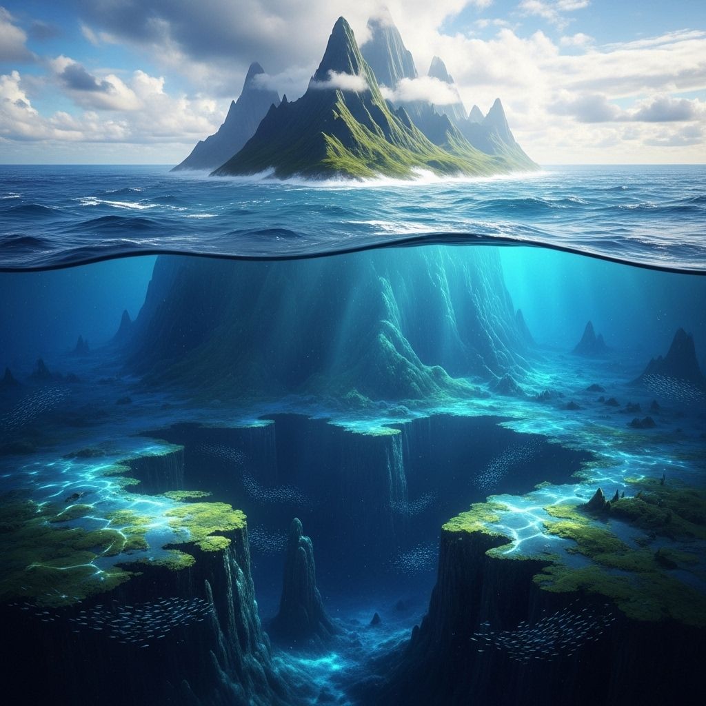
Hidden beneath the southwestern Pacific Ocean lies Zealandia, a vast landmass that is largely submerged and often referred to as Earth’s eighth continent. Despite comprising almost two million square miles—more than six times the size of Madagascar—this enigmatic region remained virtually unknown to the world until recent decades. Scientists now recognize Zealandia not just as a geological oddity, but as a fully-fledged continent, revealing profound insights into Earth’s dynamic history, plate tectonics, and the evolution of continents.
What Is Zealandia?
Zealandia, also known by its Māori name Te Riu-a-Māui, is a mostly underwater continental fragment situated east of Australia. While only about 5% of its area, including New Zealand and New Caledonia, rises above the ocean surface, the remainder lies up to 3,800 feet (1,150 meters) below sea level. Zealandia’s size, geology, and crustal thickness set it apart from regular oceanic crust, supporting its status as a true continent.
- Area: Nearly 5 million square kilometers (about 1.9 million square miles)
- Exposed landmass: Only the islands of New Zealand, New Caledonia, and a few others
- Crust thickness: 10–30 km (with regions exceeding 40 km under parts of New Zealand’s South Island)
- Main components: New Zealand, New Caledonia, Norfolk Ridge, Lord Howe Rise, and other marine areas
Why Is Zealandia Considered a Continent?
Geologists define a continent by the presence of continental crust (silica-rich, thick, and buoyant), distinct geology, clear boundaries, and significant size. Zealandia meets all these criteria:
- It shares strong geological similarities with other continents, including diverse rock types (granite, greywacke, volcanics, metamorphics).
- It is physically isolated from Australia by the Cato Trough and other deep oceanic regions.
- Its crust is much thicker than typical oceanic crust.
- It has a well-defined area encompassed by shallow marine plateaus and ridges.
How Was Zealandia Discovered?
For centuries, the submerged landmass was overlooked, misclassified as scattered islands, continental fragments, or a collection of submarine plateaus. However, mounting evidence since the mid-20th century, including seismic data, geological core samples, and sophisticated satellite gravity mapping, revealed Zealandia’s true extent and nature.
In 2017, a team of GNS Science geologists and international collaborators published breakthrough research in the journal GSA Today. Their findings synthesized decades of field data, shipboard surveys, rock samples, and crustal thickness measurements, solidifying Zealandia’s case as Earth’s eighth continent.
Key Milestones in Zealandia’s Scientific Recognition
- 19th century: Observations of submerged plateaus around New Zealand and New Caledonia
- 1969–2000s: Advances in marine geology and plate tectonics reveal underlying continental crust
- 2017: Publication of ‘Zealandia: Earth’s Hidden Continent’ in GSA Today
- 2017–2023: International Ocean Discovery Program expeditions retrieve seabed cores, confirm continental geology, and expand understanding of Zealandia’s structure
- 2023: Completion of comprehensive geological mapping, making Zealandia the first continent ever fully mapped to its submarine boundaries
The Geological Story of Zealandia
Zealandia’s origins trace back to the ancient supercontinents Gondwana and Rodinia. Studies show its oldest rocks were once part of Rodinia, which existed over a billion years ago. Its more recent history, however, is intricately linked with the breakup of Gondwana around 85–100 million years ago.
Formation and Sinking: From Gondwana to the Ocean Floor
As Gondwana fragmented, Zealandia began pulling away from what is now Antarctica and Australia. Unlike other continental pieces, Zealandia experienced significant thinning and stretching of its crust, rendering it unable to float at higher elevations like most landmasses.
About 85 million years ago, Zealandia drifted slowly into the Pacific, with much of it gradually sinking beneath the waves. Today, only a small percentage remains above sea level, forming New Zealand and nearby islands.
Tectonic Forces and the Ring of Fire
New research indicates Zealandia’s submersion was not a simple, singular event. Between 50 and 35 million years ago, parts of Zealandia rose and fell in dramatic cycles, coinciding with changes in global tectonic plate movements and the initiation of the Pacific ‘Ring of Fire’—a belt of intense seismic and volcanic activity that still rings much of the ocean.
- Portions of Zealandia experienced uplift and subsidence by 1–2 kilometers during periods of intense tectonic change.
- Subduction and separation of Zealandia from its ‘root’ led to extensive volcanic and seismic activity.
- Ring of Fire formation provided crucial context for understanding Zealandia’s geological transformation.
Mapping the Submerged Continent: A Scientific Breakthrough
Mapping Zealandia was a colossal challenge due to its submerged nature and vast expanse. The recent completion of the full mapping marks a significant achievement for geological sciences worldwide.
Steps in the Mapping Process
- 2017: Initial geological evidence demonstrated Zealandia’s size and continental characteristics.
- 2019–2021: Scientists mapped granites and lavas across the submerged Campbell Plateau and other regions, revealing Zealandia’s architecture and formation processes.
- 2023: Final northern sections documented, identifying a backbone-like ridge and a large volcanic province as big as the entire land area of New Zealand.
- Achieved the first complete geological, volcanic, and sedimentary map of a continent to its oceanic boundaries.
Notable Geological Features
- Fairway Ridge: Dredged seabed rocks revealed the nature of Zealandia’s northern stretches.
- Giant Volcanic Region: Discovery of a subaqueous volcanic province comparable in size to modern New Zealand.
- Twisted Crust: The crust of Zealandia displays signs of intense stretching, twisting, and thinning due to tectonic events during its breakup from Gondwana.
Why Zealandia Matters
Zealandia is more than a geographic curiosity; it is a scientific treasure trove for understanding both continental formation and Earth’s tectonic evolution. Its discovery and subsequent mapping have transformative implications for Earth sciences, resource exploration, and even the way schoolchildren may learn world geography in the future.
- Earth History: Offers a unique laboratory for studying continental rifting, plate tectonics, and sedimentary processes.
- Biodiversity: New Zealand and New Caledonia are home to distinctive plants and animals, shaped by Zealandia’s isolation and submergence over millions of years.
- Natural Resources: While most of Zealandia is inaccessible under deep water, its continental crust makes it a region of interest for future resource management.
Shaping Scientific and Public Perceptions
There is no formal international panel to officially designate new continents. Nevertheless, as research continues, Zealandia’s existence gains more recognition in scientific literature and education. Its presence is expected to become a common feature of maps and atlases in years to come.
Comparing Zealandia to Other Continents
| Feature | Zealandia | Other Continents (average) |
|---|---|---|
| Total Area | ~5 million km2 | ~30 million km2 |
| Exposed Above Water | ~5% | Majority |
| Continental Crust | 10–30 (up to 40) km thick | 20–45 km thick |
| Distinct Geological History | Yes | Yes |
Frequently Asked Questions (FAQs)
Is Zealandia officially recognized as a continent?
While there is no formal world authority for continent status, the geological evidence for Zealandia’s continental identity is widely accepted in the scientific community and regularly cited in peer-reviewed literature. Widespread adoption on maps and in education is expected with time.
How much of Zealandia is visible above sea level?
Only about 5% of Zealandia is exposed above the ocean, mainly as New Zealand, New Caledonia, and a few small islands. The remaining 95% lies submerged beneath the Pacific Ocean.
Why did Zealandia sink beneath the sea?
Zealandia’s descent was primarily due to the thinning and stretching of its continental crust as it broke away from Gondwana. Later tectonic forces, especially related to the formation of the Pacific ‘Ring of Fire,’ altered its elevation and led most of it to sink.
Are there unique species on Zealandia?
The exposed portions of Zealandia, notably New Zealand and New Caledonia, are famous for their unique and ancient plants and animals, which evolved in isolation for millions of years.
How was Zealandia mapped?
Scientists used a combination of seabed rock sampling, seismic studies, satellite gravity mapping, and deep-sea exploratory drilling to chart Zealandia’s geological boundaries, crustal features, and volcanic regions.
Will Zealandia appear in future world maps?
As the scientific consensus strengthens and educational resources adapt, Zealandia is anticipated to be included on world maps and globes alongside the existing seven continents.
References (for further reading)
- GNS Science: Zealandia just became the first ever continent to be completely mapped
- Popular Mechanics: Zealandia, Earth’s Hidden Eighth Continent, Is No Longer Lost
- NSF: Sinking of Zealandia, Earth’s hidden continent, linked to forging of the Pacific ‘Ring of Fire’
- Wikipedia: Zealandia
References
- https://www.popularmechanics.com/science/environment/a65551203/earth-eighth-continent-zealandia-is-mapped/
- https://www.nsf.gov/news/sinking-zealandia-earths-hidden-continent-linked
- https://www.gns.cri.nz/news/zealandia-just-became-the-first-ever-continent-to-be-completely-mapped/
- https://en.wikipedia.org/wiki/Zealandia
- https://www.youtube.com/watch?v=-dw_0iqL3oY
- https://www.jpost.com/science/science-around-the-world/article-855433
- https://pubs.geoscienceworld.org/gsa/geology/article/49/8/1009/598229/A-hidden-Rodinian-lithospheric-keel-beneath
Read full bio of medha deb


