What Are Diablo Winds? The Science and Risks Behind California’s Fiercest Gusts
Diablo winds threaten California with intense gusts, extreme dryness, and wildfire danger. Learn their origins, impacts, and safety measures.

What Are Diablo Winds? Understanding California’s Extreme Weather Phenomenon
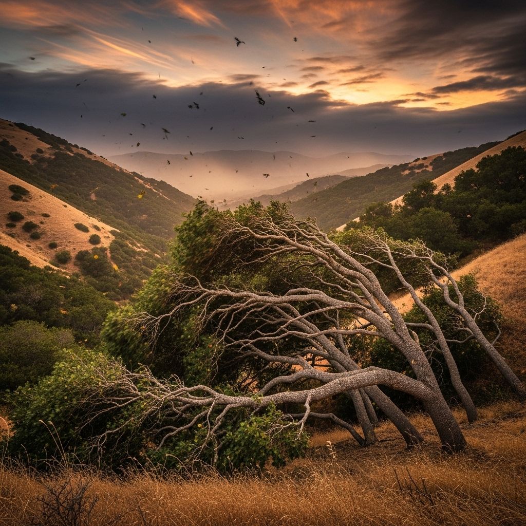
Diablo winds are hot, dry, and powerful easterly winds that sweep across the San Francisco Bay Area and Northern California, dramatically raising wildfire risk and causing widespread hazards each year. Named after Mount Diablo—a prominent peak in Contra Costa County—the phenomenon describes the fierce winds that descend from inland elevations, often arriving most violently in fall when vegetation is dry and conditions are ripe for disaster.
Origins and Name: Diablo Versus Santa Ana
The Diablo wind is so called because it blows from the direction of Mount Diablo towards the Bay Area and beyond. The Spanish word “diablo” translates to “devil,” a chilling reminder of the wind’s fiery potential .
- Named After: Mount Diablo, elevation 3,848 feet, notorious for strong winds.
- First Appearance: The term emerged after the devastating 1991 Oakland firestorm, distinguishing these winds from Southern California’s Santa Ana winds.
- Romantic Notion: The “devil wind” label highlights both the meteorological danger and the legendary aura surrounding these gusts.
- Scientific Name: These are known as Foehn winds, a type of dry, warm wind downsloping from mountains.
Diablo Winds Formation: The Science Explained
The formation of Diablo winds involves a distinct pressure pattern and atmospheric dynamics, resulting in intense, dry gusts that have outsized impacts on regional ecosystems and communities .
- Pressure Difference: High surface pressure develops over the northern Great Basin (often Nevada), while lower pressure settles offshore near California’s coast.
- Air Movement: Air travels from east to west, sweeping from the high desert over the Sierra Nevada, down into the Sacramento Valley, then up and over the Diablo Range into the Bay Area.
- Compression & Warming: Descending air compresses, raising temperatures as much as 20°F (11°C) and drastically lowering relative humidity.
- Seasonal Occurrence: Most common in spring and fall, but extremely dangerous in fall due to dry vegetation at the end of California’s Mediterranean dry season.
This pattern reverses the typical summer flow, which draws cool, moist air from the Pacific Ocean inland. Instead, during Diablo wind events, hot, dry air sweeps west toward the coast, turning hillsides into kindling.
Key Meteorological Features of Diablo Winds
- Wind Speeds: Diablo winds can reach hurricane-force gusts—exceeding 60 mph regularly, with peaks over 80 mph on ridges and mountain peaks .
- Temperature Spikes: Rapid warming and drying accompany the wind, further decreasing humidity.
- Hydraulic Jump: The thermodynamic structure leads to strong ridge-top downslope events or hydraulic jumps, increasing wind velocity sharply at elevation .
- Trajectory Shifts: Winds often begin northerly but shift to northeast as the event intensifies, channeled over ridges and down canyons.
Why Are Diablo Winds So Dangerous?
Diablo winds pose grave dangers, primarily due to their role in driving catastrophic wildfires in Northern California. These risks stem from a devastating combination of speed, dryness, and timing:
- Wildfire Spread: Powerful gusts can push flames rapidly westward, outpacing containment and endangering lives.
- Vegetation Dryness: Fall brings the highest risk, as plants are driest after the long Mediterranean summer.
- Fire Weather Warnings: Authorities issue Red Flag Warnings during peak Diablo events, signaling extreme fire danger .
- Infrastructure Hazards: Power outages and property damage are common due to wind-driven debris and equipment vulnerability.
- Historic Tragedies: The 1991 Oakland firestorm, one of the most infamous disasters, was fueled by Diablo wind conditions.
The Diablo Wind vs. Santa Ana Winds: Similarities and Differences
| Feature | Diablo Winds | Santa Ana Winds |
|---|---|---|
| Location | Northern California (Bay Area, Coast Ranges) | Southern California (Los Angeles, Inland Empire) |
| Origin | Mount Diablo, Great Basin high pressure | High desert (Mojave), Great Basin |
| Wind Direction | East/Northeast → West | Northeast → Southwest |
| Peak Season | Spring & Fall (most dangerous in Fall) | Fall & Winter |
| Danger | Wildfires, power outages, property loss | Wildfires, dust storms, health hazards |
| Scientific Type | Foehn Wind, Hydraulic Jump | Katabatic, Gap Flow |
Despite similarities—both are fierce, dry, fire-stoking winds—the Diablo wind is usually felt first and most intensely atop ridges and mountain peaks, thanks to the unique topography and thermodynamics of Northern California .
Where and When Do Diablo Winds Strike?
- Primary Area: East Bay (San Francisco Bay Area), spreading across the northern Coast Ranges.
- Pattern Frequency: Peak risk is September through November, but events also occur in spring.
- Secondary Areas: Marin, Sonoma, Napa Counties; the winds can channel into valleys and urban areas, exacerbating danger.
Profiles of Recent Major Diablo Wind Events and Disasters
- 1991 Oakland Firestorm: An infamous wildfire fed by Diablo winds consumed thousands of homes and led to tragic loss of life. This event spurred broad awareness of the phenomenon and inspired the local adoption of the term “Diablo wind.”
- 2017 North Bay Fires: The deadly Tubbs, Atlas, and other fires were rapidly escalated by intense Diablo gusts, leading to extensive evacuations and destruction.
- 2020 Glass Fire: High winds again propelled wildfires through Napa and Sonoma, challenging firefighters and threatening communities.
Diablo Winds and California’s Mediterranean Climate
California’s Mediterranean climate produces long dry spells from May through October. By autumn, vegetation is baked dry, turning even small sparks into potential disasters when Diablo winds roar in .
- Drought Exacerbation: Months of little or no rain leave forests, grasslands, and shrubbery highly flammable.
- Combined Effects: Dry fuels plus extreme winds make fire control nearly impossible during peak events.
How Scientists Monitor and Forecast Diablo Winds
- Weather Models: Meteorologists track pressure differences across the Great Basin and coastal regions to predict wind patterns.
- Red Flag Warnings: Issued when winds, humidity, and temperatures create high fire risk.
- Advanced Sensing: Satellite imaging, wind sensors, and computer models allow for better prediction and quicker response.
Safety Tips: Preparing for Diablo Wind Events
- Stay Informed: Follow local news and weather alerts, especially Red Flag Warnings.
- Emergency Kits: Prepare essential supplies, vital documents, and evacuation plans.
- Fire-Resistant Landscaping: Remove dry vegetation, maintain defensible space around homes.
- Secure Loose Items: Strong winds can turn outdoor furniture and branches into dangerous projectiles.
- Backup Power: Anticipate outages due to wind-driven equipment failures or precautionary power shutoffs.
Diablo Winds and Community Actions
Local agencies and residents must work together to reduce fire risk and respond effectively during peak wind events:
- Fire Safe Council Programs: Community outreach and education on wildfire safety and preparedness.
- Wildfire Mitigation: Controlled burns, fuel reduction projects, and updated building codes.
- Power Utilities: Proactive power shutdowns during Red Flag wind events to reduce accidental ignitions.
- Evacuation Plans: Mapping safe evacuation routes, ensuring clear communication between agencies and the public.
Frequently Asked Questions (FAQs)
Q: What makes Diablo winds different from regular winds in California?
A: Diablo winds are much stronger, hotter, and drier than typical coastal breezes. Their unique formation, involving high pressure and descending air, creates extraordinary wildfire risk.
Q: Are Diablo winds predictable?
A: Meteorologists can forecast Diablo wind events by monitoring pressure gradients across the Great Basin and the coast, but exact intensity and timing vary.
Q: Why are Diablo winds associated with such extreme fire danger?
A: The combination of dry vegetation (from the long summer dry season), low humidity, and powerful gusts creates ideal conditions for wildfires to start and spread rapidly.
Q: How can residents prepare for Diablo wind-driven fires?
A: Maintain defensible space, heed Red Flag Warnings, secure outdoor items, and prepare to evacuate quickly if necessary.
Q: Has climate change affected Diablo wind events?
A: Some research suggests that prolonged droughts and changing weather patterns may increase both the frequency and intensity of wind-driven wildfires in California.
Conclusion: Living With the Diablo Winds
The Diablo wind is a defining force in Northern California’s landscape—one that has shaped its fire seasons, emergency planning, and everyday life for decades. Understanding these powerful winds is key to preparing for their hazards and reducing their risks in a climate increasingly prone to extremes.
Diablo Winds: Key Takeaways
- Diablo winds are hot, dry easterly winds formed by unique pressure and atmospheric conditions, most dangerous in fall.
- They drive wildfire outbreaks in Northern California, including historic disasters.
- Preparation and awareness are essential for communities in affected regions.
- The science behind these winds highlights the complex interplay between weather, climate, and geography in California.
References
- https://skybrary.aero/articles/diablo-wind
- https://www.accuweather.com/en/severe-weather/what-are-diablo-winds/613878
- https://ggweather.posthaven.com/a-diablo-winds-primer
- https://firesafemarin.org/prepare-yourself/red-flag-warnings/diablo-winds/
- https://en.wikipedia.org/wiki/Diablo_wind
- https://www.fireweather.org/diablo-winds
- https://abc7ny.com/what-are-diablo-winds-how-can-influence-northern/5644600/
- https://www.aol.com/weather-words-diablo-winds-124918587.html
- https://macmaq.aqrc.ucdavis.edu/sites/g/files/dgvnsk6036/files/inline-files/Yi-Chin%20Liu%20-%20Complex%20Terrain%20Coastal%20Zone.pdf
Read full bio of medha deb


