Volcanoes as Seen from Space: Unveiling Earth’s Fiery Giants
Spectacular satellite imagery reveals volcanoes’ dramatic eruptions, scientific insights, and early warning systems from above.

Volcanoes as Seen from Space: A Satellite-Eye View of Earth’s Fiery Giants
Volcanoes have captivated humanity with their awesome power, unpredictability, and ability to shape landscapes in moments. Thanks to powerful satellites and orbiting observatories, we now witness volcanoes from a vantage point that reveals not only their grandeur but also vital clues to their behavior and risks. This article guides you through stunning imagery, scientific advances, and the importance of monitoring volcanoes from space.
Why View Volcanoes from Space?
Observing volcanoes from above provides unique knowledge that is otherwise inaccessible from ground level:
- Wide Perspective: Satellites offer comprehensive views of entire volcanic systems, surroundings, and the effects of eruptions on landscapes and populations.
- Continuous Monitoring: Space-based imaging enables uninterrupted monitoring, capturing eruptions in real time and tracking changes before and after volcanic events.
- Early Warning: Remote sensing of heat, ash, and gas emissions can provide crucial early signs of volcanic unrest, protecting lives and property.
- Global Coverage: Orbiting observatories can survey even the most remote or inaccessible volcanoes, broadening scientific understanding and risk preparedness.
Stunning Satellite Images: Revealing the Beauty and Danger
Recent advances in satellite imaging allow us to see volcanoes in remarkable detail. Here are some of the most iconic volcanoes as photographed from space:
Mount Vesuvius, Italy
Mount Vesuvius is one of the world’s most notorious volcanoes, famed for its catastrophic eruption in A.D. 79 that buried Pompeii and Herculaneum. Its proximity to Naples and millions of inhabitants makes it a focal point for satellite-based risk assessment. From orbit, Vesuvius appears as a mighty crater rising from lush, populated plains, with urban areas crowding its flanks, highlighting the disaster potential if it erupts again.
Krakatoa, Indonesia
Krakatoa sits in the Sunda Strait, infamous for its 1883 eruption that triggered massive tsunami waves and global climate impacts. Images from space reveal the volcano’s fragmented islands and active cone, often smeared by volcanic ash plumes and surrounded by ocean. Ongoing eruptions are caught on camera, with ash fans drifting over water—reminders of Krakatoa’s volatile nature.
Klyuchevskoy, Russia
In Russia’s Kamchatka Peninsula, Klyuchevskoy stands as Eurasia’s tallest active volcano. Astronauts and satellites capture its perfect cone erupting spectacularly, snow-capped slopes cut by dark rivers of lava. The remote region may be largely uninhabited, but volcanic clouds can disrupt air travel and the regional ecosystem.
Mount Taranaki, New Zealand
Mount Taranaki is a stratovolcano on New Zealand’s North Island, symmetrically rising over green forests and farmland. It is often photographed from orbit due to its striking contrast with the surrounding landscape—a nearly perfect circle of lush vegetation against the volcanic terrain, occasionally veiled by clouds or snow.
How Satellites Detect Volcanic Activity
Satellites support scientists, emergency managers, and ecologists by making a wide range of measurements crucial to volcano monitoring:
- Thermal Imaging: Detects heat signatures from rising magma, fresh lava flows, or abnormal warmth around vents.
- Infrared and Visible Light: Captures ash plumes, eruption clouds, and landscape changes from eruptions.
- Gas Emissions: Tracks emissions such as sulfur dioxide and carbon dioxide, which signal magma movement and eruption risk.
- Vegetation Changes: Reveals indirect signs of volcanic unrest as trees absorb gases and change color, potentially indicating imminent eruptions.
Earth’s Dynamic Volcanic Landscapes
From snow-capped peaks to steaming craters and tropical islands fractured by blasts, volcanoes shape environments in profound ways. Space imagery documents the transformation of landscapes:
- Calderas and Crater Lakes: Eruptions can create dramatic depressions filled with water or surrounded by barren ground.
- Flows and Lava Fields: Dark rivers of cooling lava snake across land after eruptions, visible in contrast against greenery or snow.
- Ash and Pyroclastic Deposits: Grey and brown streaks from explosive eruptions cover vast areas, altering plant life and regional climate.
Case Study: Tree Canopy Clues and Carbon Dioxide Detection
One revolutionary development in early-warning science is the use of vegetation color as an indicator of impending eruptions. When magma rises, it releases carbon dioxide, which trees absorb through their leaves. Affected trees may become notably greener (subtle to the naked eye but detectable with satellite instruments).
| Indicator | What It Reveals | Satellite Role |
|---|---|---|
| Tree leaf color change | Absorption of volcanic CO2; possible eruption | Earth-observing satellites analyze spectral changes |
| Sulfur dioxide emission | Active magma movement; eruption likely imminent | Detectable in satellite imagery |
| Thermal hotspots | Rising magma or new lava flows | Infrared sensors observe temperature anomalies |
NASA, ESA, and partner institutions have combined fieldwork with remote sensing to verify these findings. For instance, spectrometers onboard research planes measured leaf color near Costa Rica’s Rincon de la Vieja volcano, coordinated with CO2 sensor readings and ground surveys. These interdisciplinary efforts improve volcanic early warning systems, especially where people live near high-risk volcanoes.
Satellite Missions and Remote Sensing Technology
The following missions have played pivotal roles in volcano monitoring:
- Landsat 8 (NASA): Provides high-resolution color and infrared images, supporting vegetation, thermal, and geological studies.
- Terra (NASA): Delivers multispectral imagery for analyzing ash clouds, surface changes, and environmental impact.
- Sentinel-2 (ESA): Adds European capability to monitor terrestrial landscapes, volcanic emissions, and eruption aftermaths.
These satellites capture change over time, revealing cycles of activity, dormant phases, and landscape recovery.
Impact of Volcanic Eruptions on People and the Planet
Approximately ten percent of humanity lives in volcanic hazard zones. The consequences of eruptions observed from space include:
- Direct Hazards: Lava, rocks, and pyroclastic flows can destroy infrastructure and threaten lives.
- Secondary Effects: Eruptions may trigger mudslides, tsunamis, and long-lasting ash deposits, endangering communities far beyond the immediate blast zone.
- Global Climate Impact: Ash and gases can disrupt weather, lower temperatures, and affect agriculture across continents.
- Ecological Shifts: Forests, rivers, and entire ecosystems may be altered as species adapt to new soils, water chemistry, or catastrophic change.
Remote Sensing Beyond Eruption Monitoring
Space-based observation is not limited to eruptions alone. Scientists and conservationists use satellite data to:
- Track volcano formation: Imaging discovers new volcanic features or reshaping of land after major events.
- Survey recovery and regrowth: Long-term monitoring records how plant and animal life returns to affected regions.
- Test disaster preparedness: Data supports risk mapping, evacuation planning, and resource allocation.
Challenges and Limitations of Space-Based Volcano Tracking
Despite its power, satellite monitoring faces several obstacles:
- Not all volcanoes are forested, limiting the effectiveness of tree canopy methods in arid or icy regions.
- Cloud cover, weather events, and technical limitations may obscure key imagery.
- Some ecological signals may mislead if affected by disease, fire, or climate variation.
- Ground-based validation is required to confirm remote observations and calibrate warning systems.
The Future of Volcano Monitoring from Space
Ongoing advancements promise even more timely and accurate volcano risk information:
- Improved sensor networks: Combining satellite, aerial, and ground data sharpens early warning capabilities.
- Artificial intelligence: Machine learning algorithms automatically flag anomalous changes, alerting scientists faster.
- Global collaboration: Cross-border data sharing enhances research and disaster response.
As urbanization increases near active volcanoes—such as Naples and Mount Vesuvius—the importance of remote sensing and international science partnerships grows ever more vital.
Frequently Asked Questions (FAQs)
Q: How do satellites detect impending volcanic eruptions?
A: Satellites analyze changes in ground temperature, gas emissions (especially sulfur dioxide), and, in forested areas, shifts in tree leaf color caused by volcanic carbon dioxide uptake.
Q: Are volcanoes visible from space during eruptions?
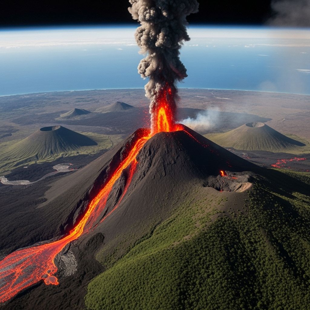
A: Yes. Volcanic ash clouds, glowing lava, and expanded thermal signatures are clearly visible from both Earth-observing satellites and the International Space Station.
Q: What is the value of monitoring volcanoes from space?
A: Space-based surveillance provides comprehensive data for risk assessment, early warning, disaster preparedness, and scientific research—all essential to protect populations and understand volcanic processes.
Q: Can every volcano be tracked with satellites?
A: Most active volcanoes are monitored with some form of satellite imaging, but limited vegetation, weather interference, and technical coverage can restrict visibility or data quality in some cases.
Q: What famous volcanoes have been photographed from space?
A: Iconic sites like Mount Vesuvius, Krakatoa, Klyuchevskoy, and Mount Taranaki are regularly captured by satellites and astronauts due to their activity, landscape, and history.
Conclusion: A Changing World Through the Eyes of Space
Volcanoes, seen from space, symbolize Earth’s raw power, beauty, and unpredictability. Satellite and space station imaging illuminate volcanoes’ impact on humanity and the planet, enabling faster, smarter responses to natural disasters. With continued advances, the partnership between remote sensing and ground science ushers in a new era of warning systems, landscape understanding, and appreciation for our world’s fiery giants.
References
- https://timesofindia.indiatimes.com/science/volcanoes-from-space-european-space-agency-shares-stunning-images-of-eruptions-captured-from-orbit/articleshow/123502368.cms
- https://www.nasa.gov/earth/natural-disasters/volcanoes/nasa-satellites-provide-early-volcano-warnings/
- https://www.vice.com/en/article/volcanos-warn-trees-around-them-before-erupting-and-nasa-can-see-it/
- https://www.livescience.com/planet-earth/volcanos/the-closer-a-volcano-is-to-erupting-the-greener-the-trees-around-it-look-from-space
- https://www.discovermagazine.com/trees-can-warn-us-of-volcanic-eruptions-from-space-47661
Read full bio of Sneha Tete


