Flood Risk, Inequality, and Black Communities in the US: Unraveling Climate and Social Injustice
New research reveals why Black neighborhoods face disproportionate flood risks and underscores the climate injustice behind America’s worsening storms.

Flood Risk and Black Communities: The Convergence of Climate Change and Racial Inequality
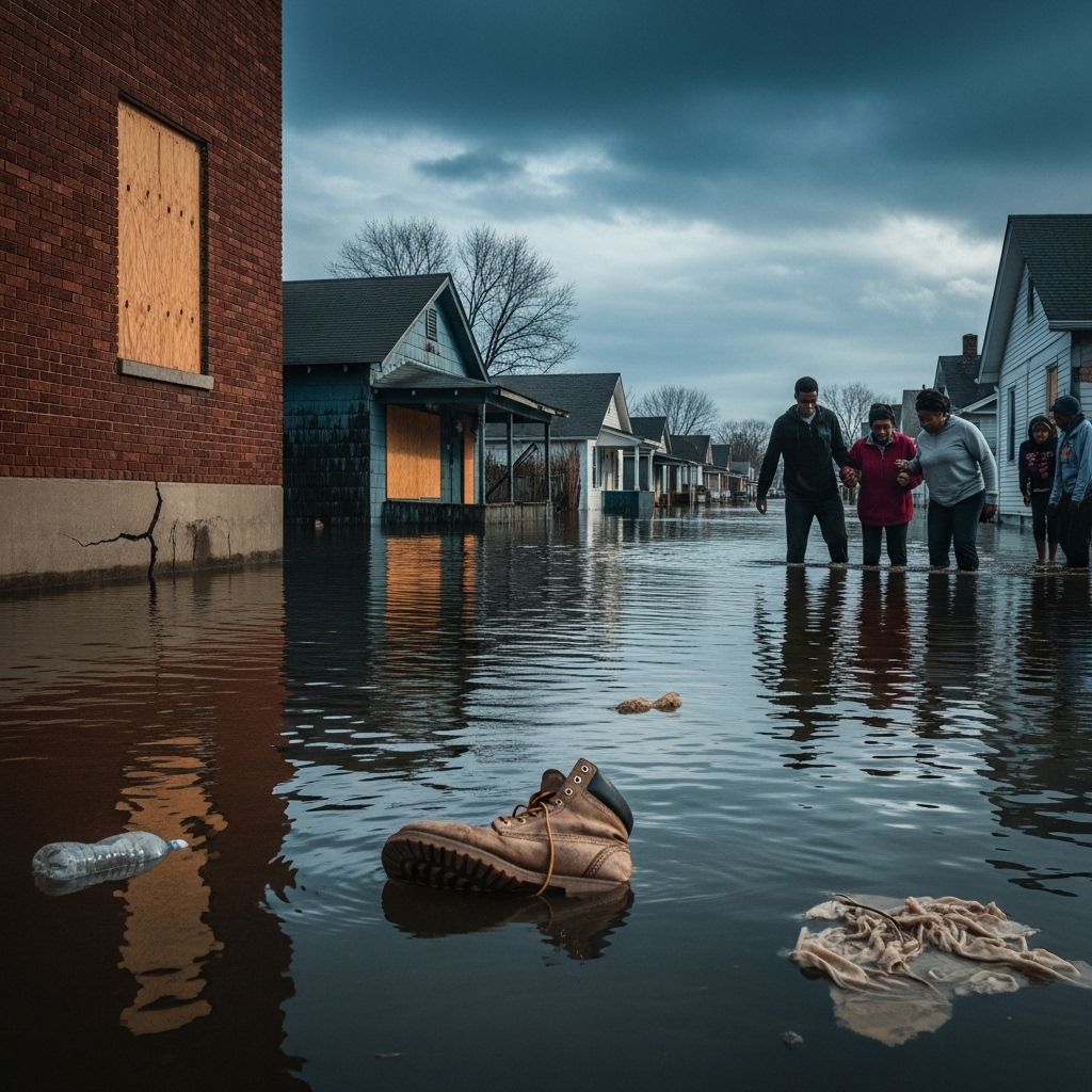
Flooding is the most frequent and costly natural disaster affecting the United States. Black communities are now at the epicenter of an increase in flood risk that is being driven by both climate change and a legacy of discriminatory policies. This article explores the patterns behind rising flood threats, historical context, the role of infrastructure and urban planning, the impacts on modern-day neighborhoods, and the solutions needed to address this deepening environmental injustice.
Understanding Flood Risk in the US
Flooding already costs the US over $32 billion annually in damages, a figure expected to climb past $40 billion each year by 2050 as the climate warms and storms become more destructive. The risk of flooding affects both riverine (inland) and coastal regions, with coastal flooding from sea-level rise and storm surges an increasing concern for eastern and southern states. Flood maps from recent studies now provide neighborhood-level detail, exposing sharp disparities in exposure across sociodemographic groups.
- Annual flood losses are expected to increase with climate change-fueled storms.
- Coastal states, especially in the Southeast and along the Atlantic, face significant risks due to rising sea levels and more intense hurricanes.
- Urban flash flooding, or “pluvial flooding,” is also increasing as weather patterns shift and development outpaces stormwater infrastructure upgrades.
How Has Flood Risk Changed—and Who Faces It?
Historically, impoverished white communities in low-lying mainland regions bore the largest burden of flood risk. But this is changing rapidly. Due to climate change and demographic patterns, Black communities and other minority populations are projected to see a much steeper rise in flood risk over the next 30 years.
- Black neighborhoods on the Atlantic and Gulf coasts are projected to see an at least 20% increase in flood risk by 2050.
- Many of these communities are in both urban and rural settings in states such as Florida, Virginia, and Texas.
- Other communities of color, including Latino, Asian, and Indigenous groups, also face rising flood and climate risks, particularly where poverty and infrastructure decay are present.
The Urban Flooding Problem
Within large US cities, Black Americans are disproportionately concentrated in core metropolitan areas—the very places where urban flash flooding risk is most acute. Nearly 85% of the Black population in the contiguous US lives in these urban core areas, making them especially vulnerable to flooding caused by heavy rainfall and overwhelmed drainage systems.
- Urbanization and development have reduced green, absorbent land, increasing stormwater runoff.
- The impacts of heavier, more frequent downpours are exacerbated by outdated stormwater infrastructure.
- “Redlined” city districts, often home to minority populations historically denied investment and basic public services, are among the most flood-prone zones today.
The Legacy of Redlining and Environmental Racism
The United States’ racialized history has shaped its urban geographies, often with deadly environmental consequences. In the 1930s and beyond, banks and insurers refused loans to largely Black or minority populations in areas marked “undesirable” on government maps—a practice known as “redlining”. These neighborhoods, shown in red, were typically built on less desirable land, including floodplains. Decades of underinvestment in infrastructure left them without proper drainage, green space, or storm protections.
- As of recent studies, about $107 billion in housing exists in formerly redlined zones at high flood risk.
- Nearly 60% of households in these areas are non-white, compared to just 40% in neighborhoods historically preferred for mortgage lending.
- This pattern of concentrated flood risk is a direct legacy of racist lending and investment policies.
Table: Formerly Redlined vs. Non-Redlined Neighborhoods
| Redlining Status | % Non-White Households | Total Housing at High Flood Risk |
|---|---|---|
| Formerly Redlined Areas | ~60% | $107 billion |
| Greenlined (Preferred for Loans) | ~40% | $85 billion |
The Data: Unequal States of Flood Risk
The convergence of race, income, and geography can be seen in the detailed results of new modeling efforts:
- Coastal communities in Florida, Virginia, Texas, and other Gulf and Atlantic states will see the steepest increases in risk for majority-Black neighborhoods.
- Low-income and Black communities, including those in major metropolitan areas like Los Angeles and Houston, face greater exposure to both “100-year” floods (with a 1% annual chance) and more frequent nuisance floods.
- In Los Angeles, Black residents are up to 79% more likely than white residents to experience waist-high flooding during major storm events.
Pluvial Flooding and Metropolitan Disparities
Recent research distinguishes so-called “federally-overlooked” flood zones, often left off official hazard maps, where the risk to Black populations is especially high. These areas, also known as pluvial floodplains, are found predominantly in city cores with:
- High Black population density
- Outdated or undersized drainage systems
- Low investment in green infrastructure
- Land use patterns that leave little permeable ground to absorb excess rainwater
Climate Change Intensifies Environmental Injustice
Climate change serves as an accelerant, worsening existing inequities. The impacts are especially severe for Black, Latino, Native American, and other marginalized groups:
- The risk of wildfires is 50% higher for Black, Hispanic, and Native American communities compared to others.
- Air pollution causes about three times more deaths for Black Americans than white Americans, according to public health data.
- Flooding will increasingly outpace adaptation in neighborhoods already struggling with poverty, poor infrastructure, and low property values.
Why Are Impacts So Unequal?
Experts cite several reinforcing factors:
- Poor drainage and lack of green space in historically neglected neighborhoods mean more flooding from the same storms.
- Low home values make it harder for residents to afford insurance, repairs, or retrofits.
- Flood risks may be underestimated by federal maps, leaving millions without knowledge or resources to protect themselves.
Case Study: Los Angeles and the 100-Year Flood
A study of the Los Angeles Basin demonstrates the phenomenon at a local level:
- Researchers found nearly 1 million people live within the region threatened by a 100-year flood, far greater than official estimates.
- Black, Latino, and Asian residents are 79%, 17%, and 11% more likely, respectively, to be exposed to catastrophic flooding than white counterparts.
- Many neighborhoods outside the FEMA-designated “special hazard” area are in fact highly vulnerable—yet residents may not be required to buy flood insurance or invest in mitigation.
Development choices, such as the paving over of natural areas and construction of inadequate drainage, have compounded the problem. Legacy social divisions and inequitable urban planning have placed certain communities in harm’s way from the outset.
Solutions: Toward Flood Resilience and Justice
Addressing America’s unequal flood risk requires both targeted adaptation and a reversal of historic injustices:
- Investments in robust flood defenses, including upgraded drainage, levees, and green infrastructure, are vital.
- Updated flood risk mapping must include detailed street-level and pluvial flood risk, not just riverine or coastal zones.
- Floodplain management and regulation should discourage risky development and incentivize preservation of absorbent land.
- Federal and local governments should prioritize adaptation resources for communities with the greatest risk and the fewest resources—often Black, Latino, and low-income neighborhoods.
- Community engagement in planning and response, ensuring solutions are locally led and culturally attuned.
- Stronger flood insurance programs with equitable access and affordability.
Equity in Adaptation: Policy Recommendations
- Control or restrict new construction in flood-prone areas, with special attention to legacy neighborhoods at risk.
- Increase spending on infrastructure upgrades in historically redlined and marginalized communities.
- Foster collaborations with local organizations, residents, and environmental groups to tailor adaptation to local realities.
Progress, Obstacles, and the Road Ahead
While policy momentum for “climate justice” is growing, barriers remain, such as insufficient funding, lack of comprehensive maps, and weak community representation in planning. The true test will be whether emergency and adaptation resources can be equitably distributed, and whether dirty legacies like redlining are finally erased from America’s landscape of risk.
Frequently Asked Questions (FAQs)
Q: Why are Black communities at greater risk of flooding in the US?
A: Black communities are more exposed to flood risk due to a history of discriminatory housing practices (such as redlining), chronic underinvestment in infrastructure, and their disproportionate presence in flood-prone urban and coastal areas. Climate change projections indicate these risks will increase sharply over the next decades.
Q: How does redlining cause higher flood risk today?
A: Redlining denied mortgages and investment to minority neighborhoods, pushing them into less desirable, flood-prone areas and preventing upgrades to drainage, housing, and green spaces needed for resilience. This legacy leaves these areas more vulnerable to present-day storms and sea level rise.
Q: Can upgrading infrastructure solve the problem?
A: Infrastructure improvements can reduce flooding, but solutions must address both drainage and the underlying inequalities. Without targeted investments in the hardest-hit areas, upgrades may widen rather than close adaptation gaps.
Q: Is climate change making flooding worse for everyone?
A: Yes, climate change intensifies storms, raises sea levels, and increases rainfall extremes nationwide. However, the impacts are not distributed equally—Black, Latino, and low-income neighborhoods are particularly at risk due to historical disinvestment and current infrastructure deficiencies.
Q: What can be done to ensure flood justice?
A: Policy responses should prioritize equitable risk mapping, adaptive infrastructure in vulnerable communities, affordable insurance, and community-driven solutions—along with reversing the effects of past discriminatory practices.
References
- https://www.weforum.org/stories/2022/07/black-communities-us-flood-risk-climate/
- https://www.nature.com/articles/s41598-025-95120-9
- https://www.latimes.com/environment/story/2022-10-31/study-says-l-a-flood-risk-is-far-greater-than-anticipated
- https://www.globalcitizen.org/en/content/black-neighborhoods-flooding-climate-change/
- https://cpree.princeton.edu/news/2024/case-study-reveals-connection-between-flood-vulnerability-and-green-spaces
- https://www.edf.org/sites/default/files/documents/African%20American%20Communities%20and%20Climate%20Change.pdf
Read full bio of medha deb


