Understanding Lake-Effect Snow: Causes, Impacts, and Patterns
Explore the science, impacts, and unpredictability of lake-effect snow, a unique and powerful weather phenomenon affecting snowbelt regions.
What Is Lake-Effect Snow?
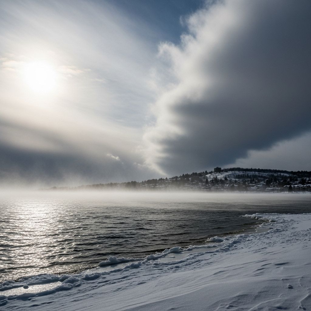
Lake-effect snow is a localized weather phenomenon that produces intense and often heavy snowfall in areas downwind of large, unfrozen lakes or bodies of water. It primarily occurs when cold, dry air moves over relatively warm waters, causing the lower layer of air to pick up moisture and heat. This moist, warmer air rises, cools, and condenses, creating bands of clouds that release snow—sometimes at astonishing rates—on the leeward shores.
This process can occur over any suitably large body of water, but is most famously associated with the Great Lakes region in North America. Similar phenomena, sometimes known as bay-effect or sea-effect snow, can form over bays and seas, such as the Baltic Sea or Sea of Japan.
How Does Lake-Effect Snow Form?
The formation of lake-effect snow is rooted in a specific set of atmospheric and geographic conditions. The essential recipe involves:
- Cold, dry air: Usually originating from the polar or arctic regions.
- Relatively warm lake water: Water retains heat longer than land, so lakes remain warmer even after the air above them cools in late autumn or winter.
- Unfrozen lake surface: Enables the transfer of moisture and heat from the water to the air.
- Steady wind direction: Moves air masses across the lake and toward the downwind shore.
Here’s a step-by-step breakdown:
- Cold air blows over the warmer water surface, picking up both heat and significant amounts of moisture through evaporation.
- This moisture-rich, warmed air becomes less dense and begins rising, initiating convection.
- As the rising air cools, water vapor condenses to form clouds. Under ideal conditions, these clouds align themselves into narrow bands along the wind direction.
- If the uplift is strong enough (sometimes aided by hills or local topography on the shore), large snowflakes can form within the clouds. These eventually precipitate out as snow on the leeward side of the lake.
- The cycle continues as long as the wind maintains its direction and the lake remains unfrozen.
Key Ingredients and Influencing Factors
- Temperature Difference: The greater the difference between the cold air and lake water temperatures (usually at least 13°C/23°F), the more moisture can be picked up and the heavier the ensuing snow.
- Fetch: The distance the air travels over the water. The longer this trajectory—known as the fetch—the more opportunity it has to gather moisture, intensifying the snowfall. Winds blowing the lengthwise direction of a large lake create more powerful snow bands.
- Wind Direction and Speed: Steady, unidirectional winds produce well-defined, often narrow snow bands. Variable or light winds create disorganized snow showers with less accumulation.
- Atmospheric Instability: A steep temperature gradient between the lake surface and the overlying air enhances rising motions and snow formation.
- Topography: Hills and ridges on the downwind side of the lake can enhance further uplift, producing even heavier snow.
- Lake Status: Once the lake surface freezes, the process is suppressed because evaporation and heating are curtailed.
Where Does Lake-Effect Snow Occur?
While most famously associated with North America’s Great Lakes, lake-effect snow can occur anywhere cold air passes over open, relatively warm water. These locations often define regional ‘snowbelts’—areas that experience much more snowfall than surrounding regions.
| Region | Examples of Water Bodies | Notable Snowbelt Areas |
|---|---|---|
| North America | Great Lakes (Superior, Michigan, Huron, Erie, Ontario) | Buffalo (NY), Erie (PA), Cleveland (OH), Syracuse (NY), Marquette (MI) |
| Asia | Sea of Japan | West coast of northern Japan |
| Europe | Baltic Sea, Black Sea, Caspian Sea, North Sea, Adriatic Sea | Coastal areas and local snowbelts |
| Other | Lake Baikal, Great Salt Lake | Surrounding regions in Russia and Utah (USA) |
When Does Lake-Effect Snow Happen?
Lake-effect snow is most common from late autumn through early winter. This timing coincides with when the lakes are still unfrozen and air temperatures drop rapidly, maximizing the temperature gradient. The phenomenon can continue throughout winter until the lake surfaces freeze solid or the temperature difference narrows.
In particularly large lakes like the Great Lakes, which rarely freeze over completely, lake-effect snow can occur persistently throughout much of the winter season.
Snowfall Intensity and Impacts
The impact of lake-effect snow can vary dramatically:
- Extreme Local Variation: Due to narrow bands, one neighborhood may receive several feet of snow while an area just a few miles away gets only a dusting.
- High Accumulations: Snowfall rates can exceed 2–5 inches (5–13 cm) per hour, sometimes resulting in storm totals of several feet.
- Travel Disruption: Sudden, intense snow squalls can cause hazardous driving conditions, blizzards, and whiteout events with little warning.
- Infrastructure Strain: Heavy, wet snow and prolonged events can challenge snow removal efforts and infrastructure maintenance in affected cities.
- Localized Effects: Lake-effect snow’s unpredictable localization means detailed, real-time forecasting is crucial for at-risk regions.
Forecasting Lake-Effect Snow
Forecasting the onset and intensity of lake-effect snow is challenging due to its localized nature and the influence of small-scale meteorological details. Meteorologists analyze a combination of data:
- Air and water temperature differences
- Wind speed and direction at various altitudes
- Stability of the atmosphere and vertical temperature profiles
- Lake water temperatures and the status (open water vs. ice cover)
- Local topography
Advanced modeling helps, but real-time reporting from weather stations and radar is critical for issuing timely warnings and advisories.
Examples of Notable Lake-Effect Snow Events
- Buffalo, New York (November 2014): Over six feet of snow buried parts of the city within just a few days, immobilizing entire neighborhoods and leading to significant emergencies.
- Syracuse, New York: Frequently ranks as one of the snowiest big cities in the United States, largely due to recurrent lake-effect snow from Lake Ontario.
- South Bend, Indiana: Regularly experiences lake-effect snow events from Lake Michigan, with heavy bands occasionally reaching well inland as far as central Indiana.
Other Related Phenomena: Bay and Sea-Effect Snow
Lake-effect processes aren’t limited to freshwater lakes. The basic mechanism applies in:
- Bay-effect snow: Occurs over large bays when cold air flows over warmer water, for example in Chesapeake Bay regions.
- Sea-effect snow: The same phenomenon over saline water bodies such as Japan’s Sea of Japan coast, the Baltic Sea, or the Black Sea. Here too, snow bands often form along prevailing wind directions and can lead to extreme local snowfall totals.
Climate Change and Lake-Effect Snow
Lake-effect snow patterns are affected by trends in both air temperatures and changes in lake ice cover:
- Later Freeze and Earlier Thaw: Warmer autumns and falls may mean lakes stay unfrozen longer, potentially increasing the duration of lake-effect snow seasons.
- Ice Cover: A decrease in ice cover due to milder winters leaves lakes open to evaporation for longer, which in some regions may enhance snowfall totals during specific cold spells.
- Shifting Patterns: Over time, climate change could alter the frequency, intensity, or timing of lake-effect snow events, though the full long-term impacts remain an active area of research.
Preparing for Lake-Effect Snow
Communities in snowbelt regions often adopt specific strategies to cope with lake-effect events:
- Robust snow removal equipment and crews are a necessity for municipalities and transportation departments.
- Building codes and infrastructure often require roofs and structures to withstand heavy snow loads.
- Public advisories and emergency alerts help residents prepare for rapid changes in weather conditions and travel hazards.
- Winter survival kits in vehicles are recommended, as travel can quickly become dangerous during intense squalls.
Lake-Effect Snow Myths and Facts
- Myth: Lake-effect snowstorms always hit the same places.
Fact: The location of the most intense snow can shift dramatically with changes in wind direction and small-scale atmospheric conditions. - Myth: Lake-effect only happens in the Great Lakes.
Fact: It occurs worldwide, wherever cold air passes over sufficiently large unfrozen water bodies. - Myth: Lake-effect only produces light snow showers.
Fact: It can generate blizzard conditions, feet of snow, and severe travel disruptions during major events.
Frequently Asked Questions (FAQs)
Q: Why does one neighborhood get buried in snow, while a nearby area does not?
A: Lake-effect snow bands can be extremely narrow. If your area is directly under a band, you may receive heavy snow while places just a few miles away see little or none.
Q: What makes lake-effect snow different from regular snowstorms?
A: Lake-effect snow forms locally and is highly dependent on the presence of unfrozen water and wind direction, while most snowstorms are produced by large-scale weather systems. Lake-effect can deliver extreme snowfall in very specific areas.
Q: When does lake-effect snow typically stop for the season?
A: It generally ends when the water bodies freeze, since ice prevents evaporation. In very large lakes, like the Great Lakes, events may persist all winter if the lakes remain open.
Q: Is lake-effect snow always heavy and dangerous?
A: Not always. Many events produce only light accumulations or squalls, but the most intense bands can create hazardous conditions very quickly.
Conclusion: The Power and Unpredictability of Lake-Effect Snow
Lake-effect snow is a vivid example of how local geography and meteorology can combine to create dramatic, unpredictable weather. Its impacts—both beautiful and dangerous—shape life, transportation, and infrastructure in the world’s snowbelts year after year.
References
- https://www.earthdata.nasa.gov/topics/atmosphere/lake-effect-snow
- https://www.accuweather.com/en/winter-weather/everything-you-should-know-about-lake-effect-snow/1718145
- https://skybrary.aero/articles/lake-effect-snow
- https://www.weather.gov/apx/les
- https://en.wikipedia.org/wiki/Lake-effect_snow
- https://scijinks.gov/lake-snow/
- https://www.michiganseagrant.org/lessons/lessons/by-broad-concept/earth-science/lake-effect-snow/
- https://www.youtube.com/watch?v=_Sx3SOdMAHQ
Read full bio of medha deb


