Sailing Drones Brave Hurricanes: Capturing Extreme Weather from the Eye of the Storm
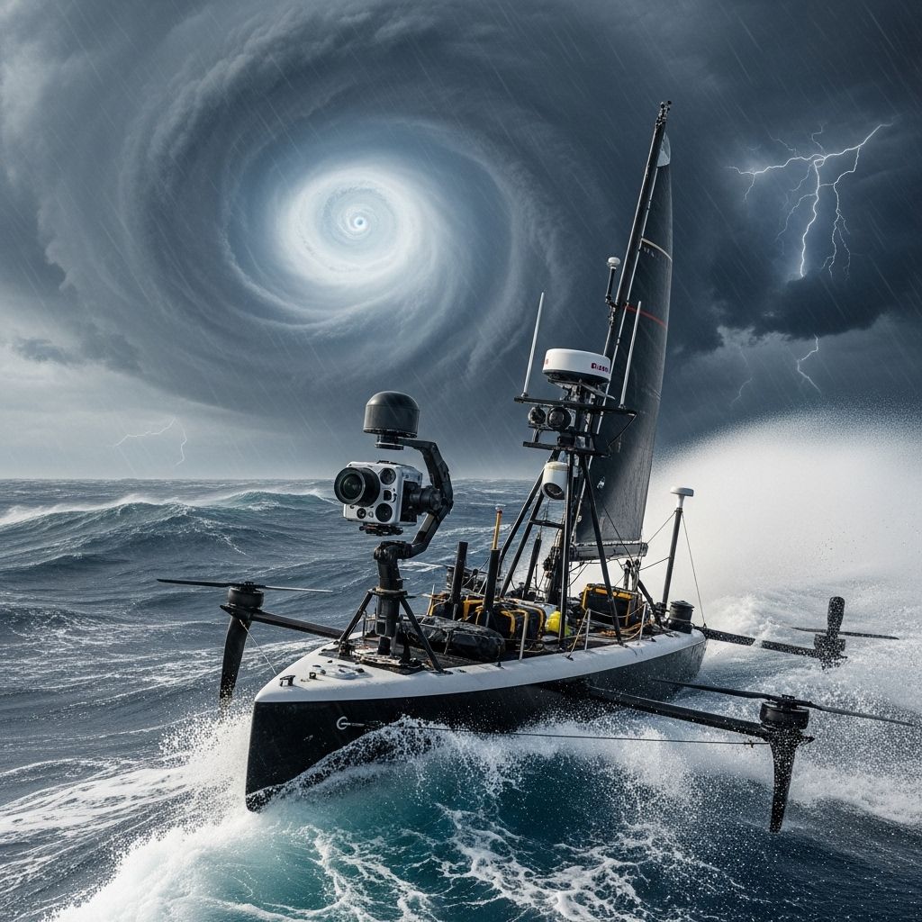
Sailing drones are revolutionizing hurricane research, venturing into the heart of storms to capture footage and data once deemed impossible.

Sailing Drones: A New Frontier in Hurricane Observation
Hurricanes represent some of the most powerful and destructive forces on the planet, with heaving seas, violent winds, and rapidly changing conditions that have historically kept researchers at a distance. Now, thanks to advances in ocean drone technology, unmanned sailing drones are boldly venturing directly into the hearts of storms, capturing unprecedented footage and gathering critical data that is transforming the field of extreme weather research.
Why Saildrone Technology Matters
- Accessing the Unreachable: Human crews and traditional ships cannot safely enter hurricane cores, but sailing drones can venture where no vessel has gone before.
- Real-time Data Acquisition: Drones transmit atmospheric and oceanographic data in real time, shaping forecasts and models as storms unfold.
- Improving Early Warning: Enhanced storm tracking and intensity prediction can save lives and property by improving disaster preparedness.
Unleashing the Power of Autonomous Ocean Drones
Sailing drones—wind- and solar-powered, remotely piloted autonomous surface vehicles—have rapidly become essential tools in hurricane science. Launched in partnership between organizations like the National Oceanic and Atmospheric Administration (NOAA) and drone manufacturer Saildrone, these craft are equipped with high-resolution cameras and an array of sensors. Deployed into the Atlantic Ocean and Gulf of Mexico, they gather constant streams of data and visuals, even as they are battered by towering waves and hurricane-force winds.
Engineering the Drones for Survival
- Durability: Each drone is engineered to withstand waves exceeding 50 feet and wind speeds over 120 mph.
- Energy Supply: The drones are powered by solar panels and batteries, ensuring multi-week missions with minimal human intervention.
- Navigation: Operators at mission headquarters remotely guide the drones, steering them towards regions of scientific interest or into the very core of a storm.
- Data Communication: Real-time telemetry is achieved via satellite links, ensuring data and video reach scientists and weather centers instantly.
Groundbreaking Footage: Hurricanes as Never Seen Before
The world received its first mesmerizing view from inside a hurricane thanks to sailing drones. The video captured tumultuous waves, racing winds, and blinding rain—scenarios previously only modeled or imagined. Some of the most dramatic footage includes:
- 28-foot Waves: Videos show colossal ocean waves engulfing the craft, highlighting the chaotic energy within a storm.
- Wind Gusts Above 75 mph: Cameras shake as the drone weathers hurricane gusts that topple trees and damage buildings on land.
- Near the Eye: Dramatic transitions occur as drones pass through hurricane eyewalls, entering eerie lulls followed by renewed fury.
Case Studies: Historic Missions
| Hurricane | Year | Key Records | Drone Achievement |
|---|---|---|---|
| Sam | 2021 | 126.4 mph wind—record for unmanned surface vehicle | Drone intercepted core, survived 50-ft waves |
| Beryl | 2024 | Category 5, 25-ft seas, 60+ mph winds | Drone captured video of rare Cat-5 cyclone in Caribbean |
| Lee | 2023 | 171 km/h gusts, 24.7 m wave height, 963.5 hPa pressure | Six drones sailed within 50 km of the eye |
| Tammy | 2023 | 72.3 kt gusts, 6.9 m significant wave height | Three drones piloted within 80 km of storm center |
| Idalia | 2023 | 43 m/s wind (84 knots), 9.6 m significant wave | Drone steered into eye in Gulf of Mexico |
The Science Behind the Mission: Data Collection in the Extreme
While the visuals are striking, the real heart of the sailing drone mission is in collecting scientific data that was historically out of reach. Each drone is packed with sensors measuring:
- Ocean Temperature: Key for tracking storm intensification
- Salinity and Currents: Understanding water mass movement and hurricane energy supply
- Atmospheric Pressure: Critical for gauging storm strength and predicting path
- Air Temperature and Humidity: Inputs for dynamic forecast models
- Wind Speed and Direction: Essential for live storm warnings
These measurements are streamed live to NOAA and the National Hurricane Center, integrated directly into models and forecasts that emergency personnel and the public depend upon during hurricane season.
What Makes Saildrone Data Unique?
- Close Proximity to Storm Core: Traditional buoys or satellites cannot track storm evolution at such short distances to the eye.
- Dynamics at the Ocean-Atmosphere Interface: Understanding how energy moves between the sea and air helps explain storm intensity changes.
- CO2 Exchanges: New missions record how hurricanes affect greenhouse gas transfer between the ocean and atmosphere, an important piece for climate science.
The Human Team Behind the Robots
Though the drones are autonomous on the water, a dedicated team of scientists and navigators guides them remotely. Mission control, often based in coastal locations such as Alameda, California, uses satellite command links to direct each craft, balancing safety with mission goals. These operators:
- Monitor drone trajectory and health
- Issue course corrections to pursue specific storm cells or regions of scientific interest
- Rapidly respond to changing ocean and atmospheric conditions
- Facilitate real-time data delivery to researchers and emergency managers
The Value of Hurricane Drone Data
The impact of sailing drone missions is far-reaching, from disaster response to long-term scientific discovery:
- Enhanced Hurricane Forecast Model Inputs: Feeding unique hurricane core data into forecasting models enables more accurate storm tracking and intensity projections.
- Disaster Preparedness: Local, regional, and national authorities use the data for advance warning, evacuation decisions, and resource distribution.
- Research and Climate Science: Multi-year data collection supports understanding of changing storm patterns in a warming ocean and atmosphere.
Cost and Investment
Deploying a fleet of these advanced drones is a major investment, costing several million dollars per year. NOAA and private sector participants, such as Saildrone, share costs and findings, recognizing that the benefit to public safety and scientific progress far outweighs the expenditure.
Milestones and Records in the Field
- 2021—Hurricane Sam: Drone survived record winds and waves, earning a Guinness World Record for highest wind speed recorded by any uncrewed surface vehicle.
- 2023—Multiplex Missions: Multiple drones simultaneously tracked different storms, providing a multidimensional data set for the first time.
- 2024—Category 5 in the Caribbean: Drones intercepted Hurricane Beryl, among the few to capture live data from the core of such a powerful system.
Challenges and Triumphs
- Extreme Conditions: Navigating waves taller than buildings, drones survive conditions designed to destroy any conventional boat.
- Data Loss Risk: High-speed winds and debris can damage sensors or knock out communications, yet redundancy and robust engineering have minimized mission losses.
- Navigation Complexity: Storm tracks shift rapidly; remote navigators must constantly adjust course to ensure drones remain in optimal observation zones without being lost.
The Future of Unmanned Hurricane Exploration
With each storm season, more drones are deployed and more data is gathered. Advances under way include:
- Increased fleet size for broader coverage
- Enhanced AI for semi-autonomous navigation
- Expanded sensor packages to include new atmospheric and oceanographic measurement capabilities
- Greater integration of drone data with supercomputer-based weather models
- Collaborations with international partners to track hurricanes globally
Key Takeaways: Why Sailing Drones are Changing Hurricane Science
- First-person footage and data from within hurricanes are vital for public safety and scientific progress.
- Real-time data supports better, faster forecasting and disaster response.
- Ongoing research using drone data is improving our understanding of hurricane dynamics and climate impacts.
Frequently Asked Questions (FAQs)
Q: How do sailing drones survive inside a hurricane?
A: Sailing drones are engineered with durable frames, waterproofing, and self-righting capabilities to withstand extreme winds, waves, and rain. Their low-profile design reduces wind resistance, and robust energy systems ensure operation under the darkest skies.
Q: What kind of data do these drones collect?
A: Drones collect surface temperature, salinity, current speeds, atmospheric parameters (such as air pressure, temperature, humidity, wind speed/direction), and now, carbon dioxide flux—offering a multidimensional picture of hurricane processes.
Q: How is the drone data used in forecasting?
A: The collected data is streamed to weather centers and directly integrated into forecast models, improving short-term predictions of storm track, strength, and potential impacts. Researchers also use long-term datasets to refine hurricane modeling further.
Q: Are there risks to losing a drone during a major storm?
A: While the environment is extreme and a small number of losses have occurred, most drones successfully complete their missions thanks to robust engineering and careful remote piloting. Even when lost, the last-transmitted data is often invaluable.
Q: What advances are expected in hurricane drone missions?
A: Larger fleets, improved navigation AI, better sensors, and deeper integration into forecasting systems are being rolled out. International collaborations are likely to make drone-driven hurricane science a global standard in the years ahead.
Q: Can the public view drone hurricane footage?
A: Yes, major missions routinely share breathtaking video and data clips with the public and media, often broadcast by NOAA, Saildrone, and news outlets. This transparency helps increase awareness and appreciation for ocean science.
References
- https://www.ktvu.com/news/saildrone-alameda-hurricane-milton-video-storm
- https://www.foxweather.com/extreme-weather/drone-caribbean-sea-video-hurricane
- https://www.pmel.noaa.gov/usv-hurricane/2023/mission-blog-2023.html
- https://www.youtube.com/playlist?list=PLO641Lrv0m1kwWleFH04LvR5Sgdqtzbue
- https://www.saildrone.com/tag/hurricane-missions
- https://www.youtube.com/watch?v=MhNZrS_ywRA
- https://www.youtube.com/watch?v=9Ijif1ZI7Gw
- https://www.youtube.com/watch?v=mVs26fiWHKY
- https://www.youtube.com/watch?v=VobQiRcivyQ
- https://www.sailworldcruising.com/video/23503
Read full bio of medha deb


