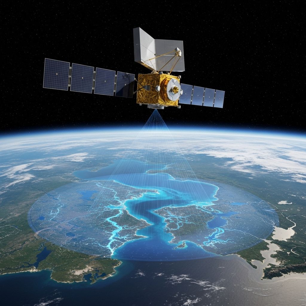
NASA’s SWOT Mission: Mapping Earth’s Surface Water in Unprecedented Detail
Exploring how NASA’s SWOT satellite revolutionizes the understanding and management of Earth's global surface water resources.

NASA’s Revolutionary SWOT Mission: A New Era for Earth’s Surface Water Mapping
NASA’s Surface Water and Ocean Topography (SWOT) mission marks a transformative step in humanity’s understanding of global water systems. Equipped with advanced satellite technology, this international mission delivers never-before-seen detail in the mapping of Earth’s surface water, unlocking crucial data for researchers, policymakers, disaster responders, and communities worldwide.
Table of Contents
- Why SWOT Matters: Global Water in Focus
- How Does SWOT Work?
- Breakthroughs and Features of the SWOT Mission
- Key Benefits and Applications
- Implications for the Planet and Its People
- Future Prospects
- Frequently Asked Questions (FAQs)
Why SWOT Matters: Global Water in Focus
Earth’s surface water—rivers, lakes, reservoirs, and wetlands—forms the lifeblood of ecosystems and civilizations. Yet historically, much of this water has proven difficult to monitor with sufficient breadth, frequency, and detail for effective management.
Key challenges in water observation have included:
- Sparse ground monitoring. Traditional systems rely on ground-based gauges, limiting coverage to accessible locations and often leaving vast, remote regions unmonitored.
- Partial satellite coverage. Previous satellite missions offered detailed data mostly over oceans or focused on very large lakes, but lacked the spatial resolution or revisit rate to track smaller water bodies and rapidly changing conditions.
- Climate and population pressures. As the climate changes and demand for freshwater intensifies, comprehensive surface water data becomes vital for understanding changing availability, disaster risks, and potential conflict drivers.
NASA’s SWOT mission directly addresses these gaps, engaging the challenge of tracking water’s movement and volume globally, and at scales meaningful for both scientific insight and practical management.
How Does SWOT Work?
Launched as a collaboration between NASA, the French space agency CNES, with contributions from the Canadian and UK space agencies, SWOT represents an innovative leap in space-based Earth observation.
Mission Overview
- Launch: December 16, 2022
- Orbit: 554 miles (891 kilometers) above Earth, covering 90% of the planet’s surface (from 78°N to 78°S latitude)
- Repeat cycle: Completes a full mapping sweep every 21 days
- Coverage: Monitors rivers wider than 330 feet (100 meters) and lakes larger than 15 acres (6 hectares)
Innovative Instrumentation
At the heart of SWOT’s technological breakthrough lies the Ka-band Radar Interferometer (KaRIn):
- Ka-band radar emits microwave signals that can penetrate clouds and provide measurements day or night, unaffected by weather.
- Wide-swath interferometry enables simultaneous high-resolution measurement of broad surface areas, capturing both small and large water bodies in detail.
- Height measurement accuracy: Measures water elevation to within 1 centimeter, with the stability of its radar boom managed to within 2 microns—about three percent the thickness of a human hair.
Unlike conventional nadir altimetry (which looks directly downward), KaRIn measures two swaths on either side of the satellite’s ground track, achieving much greater spatial coverage in each pass.
Comparison Table: SWOT versus Previous Satellite Altimetry Missions
| Aspect | Previous Altimetry Missions | SWOT Mission |
|---|---|---|
| Measurement Approach | Nadir altimetry (single-point, straight down) | Wide-swath interferometric radar (two simultaneous swaths) |
| Spatial Coverage per Pass | Narrow track, limited coverage | 120-km wide swath, large surface area covered each time |
| Resolution | Oceans and large lakes only | Rivers wider than 100m, lakes larger than 6 ha |
| Revisit Time | Variable, often >10 days | 21-day repeat cycle, global |
| All-weather Capability | Some limitations (cloud cover for optical sensors; radar with some frequency bands only) | Yes: penetrates cloud cover, day or night |
Breakthroughs and Features of the SWOT Mission
SWOT delivers a suite of unprecedented capabilities, establishing a new gold standard for hydrological remote sensing:
- Three-dimensional Mapping: SWOT captures not just surface extent but actual elevation data, permitting precise calculation of water volume and movement.
- Frequency and Consistency: With a full revisit every 21 days and high measurement stability, SWOT offers consistent, timely updates ideal for time-series analyses.
- Extensive Coverage: The mission surveys more than 90% of Earth’s surface water, providing a unified, global perspective without gaps created by inaccessible terrain or political boundaries.
- All-weather and All-season Capability: By using radar in the Ka-band, SWOT is insensitive to clouds and can operate equally in both day and night, in any season.
- Complementary Remote Sensing Products: SWOT builds on and enhances datasets provided by missions such as Sentinel-1 (radar) and Harmonized Landsat/Sentinel-2 (optical), enabling richer multi-mission analyses.
Key Benefits and Applications
The impact of SWOT’s innovations is broad, supporting a diverse field of users:
Scientific Research
- Water Cycle Analysis: Provides the data needed to trace the movement and storage of water across landscapes, linking precipitation, runoff, storage, and ocean inputs.
- Climate Change Monitoring: Detects trends in surface water extent, depth, and volume, illuminating the effects of droughts, floods, warming temperatures, and human intervention.
- Improved Hydrologic Models: Increases the accuracy and reliability of models used to forecast weather, floods, and droughts worldwide.
Water Resource Management
- Reservoir and River Monitoring: Offers precise data on river flow, lake and reservoir levels, and volume change to enable effective management, allocation, and use of water resources.
- Transboundary Waters: Provides impartial, border-crossing data crucial for international river basin management and dispute mitigation.
Disaster Preparedness and Response
- Flood Detection: Enables rapid mapping and assessment of flood extent and severity anywhere on Earth, supporting response agencies and saving lives.
- Drought Monitoring: Detects reductions in lake and river levels, flagging emerging droughts and supporting mitigation planning.
Environmental Monitoring
- Wetland Mapping: Captures change and extent of wetlands, crucial for biodiversity, carbon sequestration, and water quality research.
- Groundwater-Dependent Habitats: Provides surface proxies for changes in groundwater-fed lakes and wetlands in arid regions.
Public Policy and Societal Benefits
- Evidence-based Decision Making: Directly informs agencies and leaders seeking to allocate resources, plan infrastructure, or anticipate crises under changing water regimes.
- Education and Capacity Building: Equips academic programs and training initiatives with cutting-edge global datasets and analytical tools.
Implications for the Planet and Its People
The stakes have never been higher for managing Earth’s water. Around two-thirds of the world’s population experiences water scarcity at least one month a year, while climate-driven extremes—from flooding in Asia to drought in Africa—continually strain agricultural production, drinking water access, and infrastructure. SWOT’s unparalleled perspective will:
- Make global water knowledge accessible to under-resourced countries and empower local solutions.
- Provide real-time hazard monitoring for global disaster management and humanitarian logistics.
- Promote transdisciplinary science, linking climate research, hydrology, engineering, and social sciences through a shared dataset.
International Collaboration
SWOT’s success is built on cooperation among space agencies and scientific organizations worldwide. By sharing data openly, NASA and its partners foster innovation, resilience, and transparency in the face of planetary water challenges.
Future Prospects
As SWOT data comes online, researchers and practitioners are poised to make rapid advances:
- High-Resolution Water Forecasting: Integrating SWOT data into forecasting models will significantly improve the predictability of floods, droughts, and water resources in changing climates.
- Biodiversity and Conservation Efforts: Enhanced wetland and habitat mapping will support species protection planning and ecological restoration at landscape and regional scales.
- Urban Water Management: Cities will harness SWOT data for stormwater planning, flood defenses, and sustainable water supply allocation in a warming, expanding world.
Over the coming years, as data is analyzed, shared, and built upon, it will continue to drive scientific, societal, and environmental progress across the globe.
Frequently Asked Questions (FAQs)
Q: What does SWOT mean for ordinary people?
A: By providing more accurate, timely data on rivers, lakes, and floods, SWOT will improve water management, disaster preparedness, and even help ensure safer drinking water and more resilient infrastructure.
Q: How frequently does SWOT collect data about the entire Earth?
A: SWOT revisits and maps the planet’s surface water approximately every 21 days, delivering nearly continuous global coverage.
Q: Can SWOT see through clouds or at night?
A: Yes. SWOT uses microwave radar technology that is unaffected by weather conditions or time of day, providing consistent data globally.
Q: What are some examples of SWOT’s impact?
A: SWOT will help resource planners monitor drought risks in the American West, support flood risk management in Southeast Asia, track wetland conservation in Africa, and resolve river-sharing disputes between nations, among other uses.
Q: How does SWOT data become publicly available?
A: NASA and its partners make SWOT data accessible to researchers, agencies, educators, and the public through online portals, ensuring the broadest utility for science and society.
References
- https://www.jpl.nasa.gov/edu/resources/teachable-moment/nasa-mission-takes-a-deep-dive-into-earths-surface-water/
- https://eros.usgs.gov/doi-remote-sensing-activities/2015/usgs/nasa-surface-water-and-ocean-topography-swot-mission
- https://www.earthdata.nasa.gov/news/new-product-provides-detailed-maps-water-around-landmasses
- https://swot.jpl.nasa.gov
- https://www.earthdata.nasa.gov/learn/trainings/monitoring-global-terrestrial-surface-water-height-using-remote-sensing
- https://www.usgs.gov/news/national-news-release/usgs-maps-moon-water-supporting-nasa-mission
Read full bio of Sneha Tete


