NASA Satellites Track Microplastics Across Our Oceans
NASA satellites reveal the invisible journey of microplastics—revolutionizing how we detect, monitor, and fight plastic pollution at a global scale.

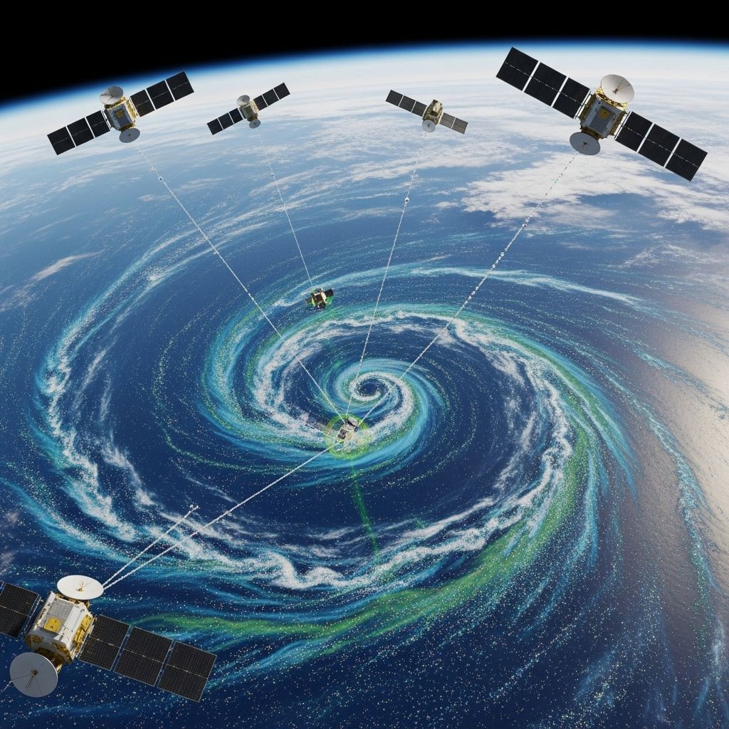
Our planet’s oceans face a quiet but growing crisis: the spread of microplastics. These minuscule particles, products of plastics weathered by sunlight and ocean waves, now drift for thousands of miles from their sources and infiltrate entire ecosystems. Tracking their movement has posed a persistent challenge—until now. NASA satellites, developed originally to track hurricane winds, are offering scientists a new window into how and where microplastics travel across the globe. This capability could mark a turning point in the fight against runaway ocean plastic pollution.
What Are Microplastics and Why Are They a Problem?
Microplastics are tiny particles—less than 5 millimeters across—that originate from the breakdown of larger plastic debris, synthetic fibers, and even everyday products. They are nearly invisible to the naked eye, yet have become a ubiquitous pollutant in aquatic environments. Scientists have found microplastics in even the most remote mountain lakes and deep-sea trenches.
- Environmental Impact: Microplastics can harm marine organisms, enter the food chain, and disrupt natural processes.
- Longevity: These resilient particles can persist in the environment for decades or centuries.
- Spread: Microplastics hitch rides on currents, distributing themselves across oceans far from their sources, making them exceptionally hard to trace and remove.
- Monitoring Hurdles: Traditional monitoring relied on patchy data from trawling nets, limiting our understanding of the scale and movement patterns of microplastics.
Traditional Limitations in Tracking Microplastics
Until recently, most data on microplastics came from sampling done by fishing and research vessels, using nets designed to capture plankton. These methods only provided localized snapshots, leaving scientists with a fragmented picture of microplastic abundance and movement.
- Sampling is labor-intensive and covers small areas at a time.
- Access to remote ocean areas is limited.
- Lack of standardized sampling techniques leads to data inconsistencies.
With no global, high-resolution method to pinpoint where concentrations accumulate, large-scale mitigation has remained out of reach.
NASA’s CYGNSS: A Hurricane Satellite Finds New Purpose
In 2016, NASA launched the Cyclone Global Navigation Satellite System (CYGNSS)—a constellation of eight micro-satellites originally intended to study hurricane wind patterns and how winds affect the ocean’s surface. By bouncing GPS signals off the water, CYGNSS takes precise measurements of surface roughness, vital for predicting the strength of cyclones.
But in 2021, scientists at the University of Michigan, led by Professor Chris Ruf and undergraduate researcher Madeline Evans, discovered a surprising secondary use:
- Surface roughness data could reveal the presence of microplastics.
- Areas with smoother surfaces than expected (given the local wind speeds) coincided with regions where microplastics tend to cluster.
How CYGNSS Detects Microplastics
Microplastics themselves do not directly affect radar reflections, but they often travel with soapy, oily films and other debris that dampen small waves, making the water appear “smoother.” CYGNSS’s radar is sensitive enough to pick up these subtle changes. By comparing observed ocean roughness to wind conditions, the presence of excess smoothness signals potential microplastic hotspots.
Breakthroughs in Ocean Observations
The new satellite technique allows for comprehensive, day-by-day tracking of microplastic concentrations worldwide. Some highlights include:
- Spotting major microplastic entry points, like river mouths — such as the Yangtze River in China, a well-known source of plastic pollution.
- Observing dynamic movement in real time, capturing how microplastics drift with currents and changing winds, and how seasonal patterns affect their dispersal.
- Identifying accumulation zones, most notably the Great Pacific Garbage Patch—the largest plastic concentration in the ocean, now visible from space via the “smooth patches” detected by CYGNSS.
Case Study: The Great Pacific Garbage Patch
By combining data from all eight satellites, researchers produced time-lapse maps clearly showing the concentration and movement of microplastics in the Pacific. Their results corroborated surface trawl studies while greatly expanding spatial and temporal coverage.
From Data to Action: Implications for Cleanup and Policy
This new space-based tracking method offers several transformative opportunities:
| Advancement | Benefit |
|---|---|
| Global Coverage | Ability to monitor all oceans regularly, not just near shipping routes or coastlines. |
| High Resolution | Tracks microplastics at spatial scales and frequencies impossible with ships alone. |
| Targeted Cleanup | Pinpoints regions where cleanup efforts can be most effective and timely. |
| Detects Trends | Allows study of seasonal and annual patterns, impacts of major storms, or changing river discharges. |
Future Research and International Collaboration
With its ability to deliver near real-time data, the approach paves the way for better international cooperation on plastic pollution. For instance:
- Governments can target regulation on rivers that export the most plastics.
- Scientific groups gain vital data for modelling impacts on marine food webs and human health risks.
- NGOs and industry initiatives can base clean-up investments on up-to-date hotspots and migration pathways.
Frequently Asked Questions (FAQs)
Q: What are microplastics and where do they come from?
A: Microplastics are plastic particles smaller than 5 mm, generated by the weathering of larger plastic debris, the breakdown of synthetic textiles, personal care products, and industrial processes. They enter oceans via rivers, runoff, and improper disposal.
Q: How can satellites like CYGNSS “see” microplastics?
A: Satellites don’t see microplastics directly. Instead, they measure the surface roughness of the ocean using radar. Microplastics and associated oily films flatten small waves, so unusually smooth water for a given wind speed indicates microplastic presence.
Q: Why is tracking microplastics so important?
A: Tracking microplastics helps scientists identify sources, predict their movement, assess risks to marine life and humans, and optimize clean-up strategies. It is essential for understanding and mitigating the global impact of plastic pollution.
Q: What is the Great Pacific Garbage Patch, and did satellites help observe it?
A: The Great Pacific Garbage Patch is a massive region in the North Pacific Ocean with a high concentration of floating plastics, mainly microplastics. NASA satellites have provided unprecedented views of its changing size and concentration over time from space.
Q: How might this technology develop in the future?
A: As techniques advance, satellites may detect even finer differences in plastic concentrations, distinguish between types of debris, and integrate with detailed oceanographic models to improve predictions.
Understanding the Broader Impact: Microplastics and Human Life
Accumulating evidence shows microplastics are not confined to marine animals—they’ve been found in drinking water, agricultural soils, and even human blood. While health impacts are still being studied, possible risks include chemical contamination and tissue damage. The ability to track these particles at a global scale could be vital in future risk assessments and pollution prevention.
Challenges and Next Steps
While promising, this satellite tracking technique is still in development. Key challenges include:
- Refining calibration of the smoothness signal to account for confounding factors (e.g., natural slicks, algae blooms).
- Integrating satellite data with in-situ sampling to better estimate absolute microplastic concentrations.
- Advancing algorithms for real-time mapping and automated detection of new pollution events such as accidental spills or storm-driven influx.
Conclusion: A New Era in Marine Pollution Monitoring
The adaptation of NASA’s hurricane-tracking satellites to monitor microplastic pollution marks a leap forward in environmental science. Scientists now have not only new tools for global surveillance but also a way to inform policies, direct cleanup operations, and ultimately, protect the health of marine ecosystems and human populations alike.
Through continued innovation and collaboration, there is hope for tackling the microplastics problem at the scale it demands—on a truly planetary level.
References
- https://www.nasa.gov/centers-and-facilities/goddard/scientists-use-nasa-satellite-data-to-track-ocean-microplastics-from-space/
- https://www.labmanager.com/scientists-use-nasa-satellite-data-to-track-ocean-microplastics-from-space-26181
- https://name.engin.umich.edu/2023/02/09/tracking-ocean-microplastics-from-space-2/
- https://www.space.com/satellites-track-ocean-microplastics-from-space
- https://earth.org/nasa-technology-ocean-plastic/
- https://www.earthdata.nasa.gov/news/feature-articles/tracking-ocean-plastic-from-space
- https://www.youtube.com/watch?v=edqeL19L3ok
- https://earth.jpl.nasa.gov/emit/applications/application-areas/plastics
- https://clasp.engin.umich.edu/2022/05/05/new-method-of-detecting-microplastics-in-the-ocean-from-satellites-in-space-wins-award/
Read full bio of medha deb


