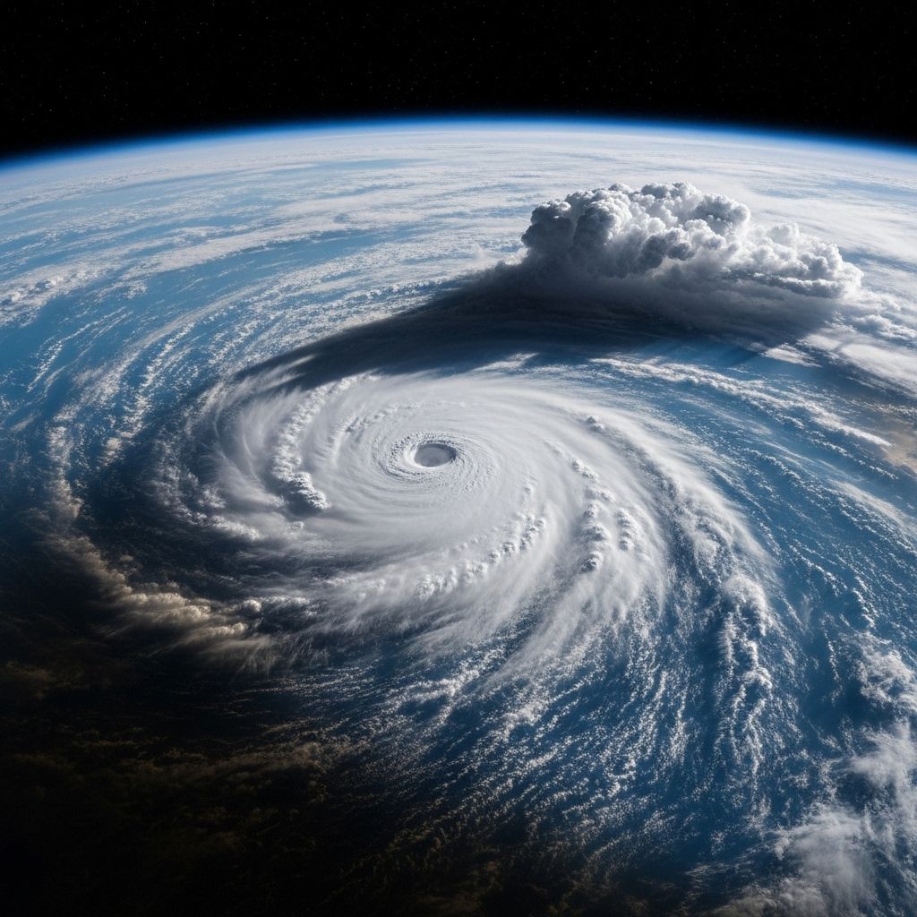
NASA’s Spectacular Images of Hurricanes from Space
How NASA captures powerful hurricanes in stunning detail from orbit, helping us better understand and prepare for Earth's fiercest storms.

Every year, hurricane season brings a dramatic display of nature’s power. While meteorologists analyze data and residents track forecasts, the most awe-inspiring views of these monstrous storms come from far above our planet. NASA and its international partners have leveraged the vantage point of space—especially the International Space Station (ISS) and advanced satellites—to capture breathtaking photographs and timelapse videos of hurricanes as they swirl across oceans and coastlines. These images not only inspire wonder but also provide critical data that help scientists and emergency managers understand, predict, and respond to major storms.
Table of Contents
- Why Hurricanes Are Photographed from Space
- How NASA Captures Hurricane Images
- Unforgettable Hurricanes Captured from Orbit
- The Science Behind Hurricane Imagery
- Insights and Applications: How Images Inform Science and Safety
- Iconic NASA Hurricane Photos and the Stories Behind Them
- Frequently Asked Questions (FAQs)
Why Hurricanes Are Photographed from Space
The vantage point of space offers a unique perspective on hurricanes. From the ISS or satellite orbits, astronauts and automated cameras can observe the full scope—sometimes spanning hundreds of miles—of a storm system. These images reveal the swirling structure of clouds, the well-defined “eye” at the center, and the intricate bands of thunderstorms wrapping around the core. This bird’s-eye perspective:
- Provides real-time data for forecasting and scientific analysis.
- Helps detect shifts in storm intensity or path.
- Documents the scale and behavior of storm systems over time.
- Raises public awareness, motivating preparedness and safety measures.
Astronauts frequently remark on the mesmerizing beauty and sheer scale of hurricanes seen from space, underscoring both Earth’s fragility and the profound power of weather systems.
How NASA Captures Hurricane Images
NASA’s hurricane images are captured through a combination of manual photography by astronauts and automated sensors on both the International Space Station and Earth-observing satellites. Key methods include:
- Handheld Cameras: Astronauts aboard the ISS use high-resolution digital cameras with powerful lenses to snap targeted photographs of hurricane features such as the eye wall, outflow bands, and lightning within clouds.
- External Cameras and Instruments: ISS is equipped with panoramic and high-speed external cameras that can take continuous images and videos as the station crosses over storm areas.
- Earth-Observing Satellites: Satellites like MODIS, VIIRS, and those in the Joint Polar Satellite System continuously monitor global weather, capturing visible, infrared, and microwave imagery of storms day and night.
These technologies allow NASA to provide both stunning visuals and vital measurements on wind speeds, rainfall, cloud-top heights, and more, directly supporting storm monitoring and disaster response.
Unforgettable Hurricanes Captured from Orbit
NASA’s image archives are filled with dramatic documentation of some of the planet’s most powerful hurricanes. These photos have become both scientific tools and vital pieces of history. Here are a few of the most memorable hurricanes captured from space in recent years:
Hurricane Milton (2024)
Hurricane Milton, a colossal storm that churned through the Gulf of Mexico before making landfall in Florida in 2024, was photographed extensively by astronauts aboard the ISS and several NASA satellites. Milton’s eye appeared clear and menacing, with dense cloud bands fanning out over hundreds of miles. Videos shared by NASA and ISS crew highlighted:
- The storm’s vast diameter and well-formed structure.
- Rapid intensification as Milton fluctuated between Category 4 and Category 5 strength.
- A nearly perfect, small eye visible in photos shot from 257 miles above Earth, exemplifying textbook hurricane formation.
The National Weather Service described Milton as “a historic storm for the west coast of Florida” due to its intensity and size.
Hurricane Igor (2010)
Captured on September 14, 2010, the Expedition 24 crew aboard the ISS photographed the dramatic eye of Hurricane Igor when it was a Category 4 monster. Located over the central Atlantic, Igor’s:
- Maximum sustained winds reached 132 mph, with gusts up to 161 mph.
- Colossal eye and expansive wind field spanned hundreds of miles.
- Striking clarity was achieved using a 180mm lens and a Nikon D2Xs camera.
This image became iconic due to its symmetry and revealed the organization required for a hurricane to reach such intensity.
Hurricane Helene
Hurricane Helene’s passage over the Atlantic and toward Florida in 2024 was also closely monitored from space. NASA images showed:
- A large, distinct eye visible from the ISS as Helene approached Florida’s Big Bend region.
- A wind field estimated to extend about 400 miles wide, showing the storm’s enormous reach.
- The clearing eye—a sign of intensification—caught vividly as Helene gained speed and power.
Such images help scientists compare current hurricanes to past storms and assess storm surge risks over wide geographic areas.
The Science Behind Hurricane Imagery
The photos and videos taken from space are far more than just dramatic visuals—they offer essential scientific insights into hurricane structure and behavior. Here’s what scientists look for in hurricane imagery:
- Eye Development: A clear, symmetrical eye indicates an intensely organized and powerful storm.
- Cloud Structure and Bands: Spiral bands reveal rain intensity and storm reach. Their formation can signal strengthening or weakening trends.
- Thunderstorm Activity: Lightning and deep convective bursts within the storm can signal where a hurricane is gaining power or may shift course.
- Outflow Patterns: The shape and motion of upper-level clouds can inform forecasts about future track and changes in wind speed.
Advanced satellite imaging also includes thermal and microwave wavelengths, which help monitor water vapor content, sea surface temperatures, and precipitation—critical for understanding what fuels hurricanes and guides their movement.
Insights and Applications: How Images Inform Science and Safety
NASA’s hurricane images have revolutionized forecasting and emergency response in multiple ways:
- Improved Forecast Accuracy: Visual data from orbit help forecasters pinpoint storm center, estimate intensity, and project track with greater confidence.
- Disaster Preparedness: Real-time images can prompt evacuations or resource deployments ahead of landfall in threatened areas.
- Climatological Research: Comparing images from past and present storms helps researchers analyze trends in storm size, frequency, and intensity—key for assessing climate change impacts.
- Public Awareness: Dramatic space-based photographs encourage people to take warnings seriously, potentially saving lives and reducing storm impacts.
Iconic NASA Hurricane Photos and the Stories Behind Them
Certain photographs have become emblematic of the power—and vulnerability—of life on Earth. Let’s look at some of the most famous hurricane images and their lasting impact:
| Hurricane | Year | Notable Image Details | Key Insights |
|---|---|---|---|
| Milton | 2024 | Ultra-clear view of the eye, wide cloud bands, time-lapse over Florida | Historic size; intensity as Category 4/5 storm; delayed ISS return |
| Igor | 2010 | Symmetrical, sharply defined eye in IOS images | Confirmed storm structure at maximum intensity |
| Helene | 2024 | Large visible eye, wide wind field, ISS photos at limb of Earth | Massive storm surge risk; rapid intensification |
These images have not only driven scientific exploration but have also inspired public engagement and mobilized greater investment in disaster preparedness and response capabilities.
Frequently Asked Questions (FAQs)
Q: Why do hurricanes look so symmetrical from space?
A: At their peak, hurricanes are highly organized weather systems, drawing energy from warm ocean waters and spinning due to the Coriolis effect. This produces the spiral shape and central “eye” seen in photos. The symmetry indicates intense, well-structured storms.
Q: What is the benefit of photographing hurricanes from the ISS versus satellites?
A: The ISS’s lower orbit and flexible observation schedule allow for oblique, close-up shots of storms, capturing details often missed by geostationary satellites. Astronauts can also target photographs in real-time as storms evolve.
Q: How do these images help communities?
A: Real-time images provide emergency managers and officials with valuable data for issuing warnings, planning evacuations, and positioning resources. They increase awareness and may prompt more timely and effective public response.
Q: Are there public archives of NASA’s hurricane images?
A: Yes. NASA makes its images freely available online, including at the NASA Earth Observatory and the Gateway to Astronaut Photography of Earth, allowing anyone to view and learn from these remarkable photographs.
Q: Can astronauts see hurricanes’ destructive effects from space?
A: While the main storm structure is visible, damage on the ground is usually too small-scale to be detected by the naked eye from orbit. However, post-storm images can sometimes reveal large-scale flooding or changes to the landscape.
Conclusion
The power and beauty of hurricanes, as revealed through the lens of space, remind us of the dynamic forces at play on our planet. NASA’s images not only inspire awe but serve as invaluable resources for science, safety, and preparedness. As imaging technologies advance, future hurricane seasons will surely bring even more dramatic, informative views from orbit—enhancing our ability to protect lives and property in the face of nature’s mightiest storms.
References
- https://www.cbsnews.com/news/hurricane-milton-photos-space/
- https://earthobservatory.nasa.gov/images/45837/hurricane-igor-from-the-space-station
- https://www.youtube.com/watch?v=WSqaM2X1li4
- https://visibleearth.nasa.gov/images/153440/hurricane-milton-crosses-florida/153443w
- https://www.youtube.com/watch?v=mm2QpALednc
- https://gpm.nasa.gov/image-gallery/hurricane-katrina
- https://www.gettyimages.com/photos/hurricane-from-space
Read full bio of medha deb


