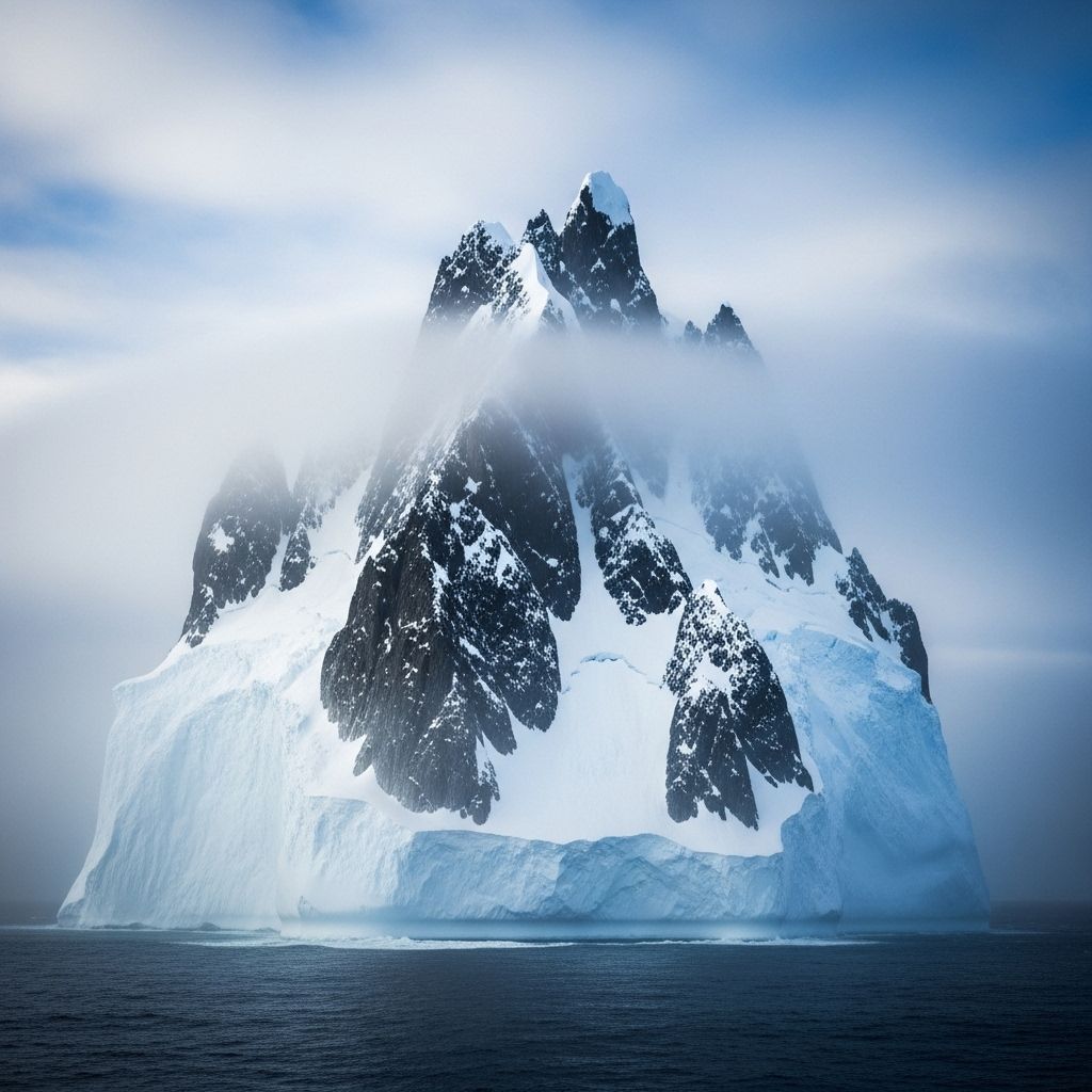
The Mystery of the Disappearing Island: When an Iceberg Masquerades as Land
A surprising case of mistaken identity highlights the shifting frontiers of our rapidly changing polar world.

The Vanishing Island: A Modern Polar Mystery
Maps are supposed to anchor us to reality. But what happens when what is charted on the map quite literally melts away? In the shifting, enigmatic regions near Earth’s poles, this bizarre scenario unfolded, causing both confusion and scientific intrigue. The tale of a disappearing island, which ultimately proved to be an iceberg, illuminates not only the fragility of our world maps but also the complex climate forces at work in these remote regions.
The Curious Case: Discovery and Disappearance
It began with navigators and explorers noting the presence of a small island in polar waters. This feature, marked on nautical charts, soon became the subject of speculation after later expeditions failed to relocate it. Was the island swallowed by the sea? Had an error occurred, or was something stranger at play? The truth was that the island hadn’t been lost in the conventional sense—it never had been solid land.
What these mariners had seen was, in fact, a massive iceberg that disguised itself as an island—long enough for its false identity to be perpetuated in official records. When the iceberg eventually drifted away or melted, the “island” simply vanished, prompting a mystery that persisted until science caught up with the shifting ice.
Why Do Icebergs Masquerade as Islands?
The dynamics of polar regions make such confusion surprisingly likely. In these high latitudes, icebergs can be enormous, with flat surfaces that easily pass for islands, especially when coated with dust, volcanic ash, or nesting seabirds’ droppings. Even seasoned explorers and advanced mapping equipment can be fooled under certain conditions.
- Visual Deception: Dense fog, low sun angles, and thick marine haze can obscure our ability to distinguish ice from land.
- Historical Mapping Practices: Earlier explorers lacked precise satellite navigation, relying on visual cues and sometimes incomplete surveys.
- Slow-Moving Giants: Some tabular icebergs, hundreds of meters thick, can remain grounded and stationary for years, further fueling the illusion that they are part of the landscape.
The Science Behind Mistaken Identities
Modern science can uncover such mistakes by analyzing satellite imagery, bathymetric (seafloor) data, and long-term observations. When discrepancies between charts and physical reality arise, scientists are prompted to re-examine presumed facts and occasionally retire islands from official maps. The vanishing ‘island’ stands as a testament to the continuing evolution of exploration in Earth’s harshest environments.
Historical Cases: Islands That Never Were
The saga of phantom islands is not confined to modern times. Throughout history, numerous islands—Sandy Island in the South Pacific, Hy-Brasil in the Atlantic—were depicted on charts for centuries before eventually being erased when thorough explorations revealed open water or passing ice where land was expected.
- Sandy Island: Charted off the coast of Australia, confirmed as non-existent by research vessels in 2012.
- Hy-Brasil: The mythical island west of Ireland showed up on maps for hundreds of years, but was never found.
- Thule: Referenced in Greek and Roman writings, its exact location (or existence) has inspired debate for centuries.
These errors typically stemmed from navigational challenges, environmental trickery, or, as in the recent iceberg case, transient features mistaken for permanent geology.
Polar Regions: Challenging Frontiers for Exploration
The Earth’s polar zones represent the last wild frontiers for cartographers and scientists. Ice movements, shifting coastlines, and extreme weather merge to make accurate mapping a relentless challenge. Occasionally, even with GPS and satellite data, the story of a place is written in mutable ice, not immutable rock.
- Dynamic landscapes: Sea ice, glacier fronts, and icebergs are constantly changing, resulting in evolving geography.
- Difficult conditions: Equipment can malfunction or provide ambiguous readings due to intense cold, magnetism, or lack of visual contrast.
- Ecological surprises: Beneath floating icebergs and shelves, entire ecosystems may remain hidden for decades, emerging only when the ice moves or melts away.
The Ecological Impact: What Lies Beneath
The mistaken identity of an iceberg for an island is not just a cartographic error—it hints at the complexity of the ecosystems that exist at the margins of ice and ocean. When icebergs break away or recede, newly exposed ocean reveals seafloors that have been secluded from sunlight and the atmosphere for centuries or longer.
Recent research has shown that these secret spaces often harbor:
- Ancient life forms adapted to darkness and cold.
- Unique microbial communities that play a pivotal role in nutrient cycles.
- Species new to science, thriving in conditions thought inhospitable.
However, when ice cover vanishes suddenly, these ecosystems can suffer abrupt disruption—temperature shifts, new predators, and sunlight exposure can dramatically alter or even obliterate such specialized life.
Climate Change and Melting Frontiers
The accelerated melting of ice in both polar regions is not simply a headline about rising sea levels. It also signals rapid changes in habitats, biodiversity, and the very nature of what we record as ‘land.’ Where an island charted yesterday may today be open ocean, tomorrow’s expedition will record a very different world.
| Feature | Iceberg | Island |
|---|---|---|
| Composition | Frozen freshwater ice | Solid rock, soil |
| Stability | Drifts, melts, shrinks | Geologically stable (over centuries) |
| Life span | Decades at most | Millions of years possible |
| Mapping reliability | Temporary, difficult to chart precisely | Permanent, stable reference |
Lessons for Exploration and Cartography
The vanishing island episode serves as a cautionary tale, underlining the necessity for:
- Continuous verification of mapped features with updated imagery and on-site investigations.
- Cautious reliance on reports from even well-meaning explorers without supporting data.
- Understanding that in an era of rapid polar change, what we know today about the coastline and landforms could alter significantly within years or decades.
Implications for the Future: Climate Signals and Geographic Realities
While an iceberg masquerading as an island might seem like a trivial oddity, the underlying message is profound. It signals:
- How much we have yet to learn—and can still misinterpret—about the planet’s remote corners.
- The need for advanced tools, open data collaboration, and humility in face of complex systems.
- The growing impact of climate change, not just on wildlife, but on the very lines we draw on global maps.
For scientists, navigators, and policy makers, every such mistake is an opportunity to refine our understanding, calibrate instruments, and reimagine the boundaries of what is known. For the wider public, such stories mystify and inspire, reminding us that even in our era of satellite imagery and supercomputing, the Earth holds secrets that defy simple categorization and resist certainty until nature itself decides to reveal the truth.
Frequently Asked Questions (FAQs)
Q: Why was the island mistaken for an iceberg?
A: The iceberg had remained stationary for years, appeared flat and island-like, and earlier explorers had no way to distinguish its true nature using the tools of the time.
Q: How did scientists eventually solve the mystery?
A: Modern mapping techniques, satellite imagery, and the absence of physical evidence for solid land at the spot revealed that the so-called island was transient ice, not rock or soil.
Q: Are there other examples of islands that never existed?
A: Yes, throughout history many ‘phantom islands’ were charted based on mistaken sightings of icebergs, fog banks, or navigational errors, later to be removed from maps.
Q: What does this mean for maps of the polar regions?
A: Maps are constantly being revised as new information comes to light. Polar regions, due to ice movement and thaw, remain particularly prone to such revisions and errors.
Q: Why is this important for climate science?
A: Understanding how and where ice masses change, break, or disappear helps scientists track not only sea-level rise but broader impacts on ecosystems, navigation, and weather.
Further Reading
- The history and science of polar exploration
- Climate change and rapid polar ice melt
- Famous mapping errors throughout the ages
References
- https://www.youtube.com/watch?v=jV4Xhlohv_o
- https://www.youtube.com/watch?v=60T1A7pHGd0
- https://www.youtube.com/watch?v=hLZqN4ibQlQ
- https://www.good.is/heres-why-marfa-lights-remain-one-of-the-most-unexplained-mysteries-in-the-united-states
- https://cartoonresearch.com/index.php/spacey-invaders-i-wars-of-the-worlds/
Read full bio of medha deb


