How to Use the USDA Planting Zone Map for Garden Success
Learn how to use the USDA Planting Zone Map to select the best plants for your climate and maximize your gardening success.

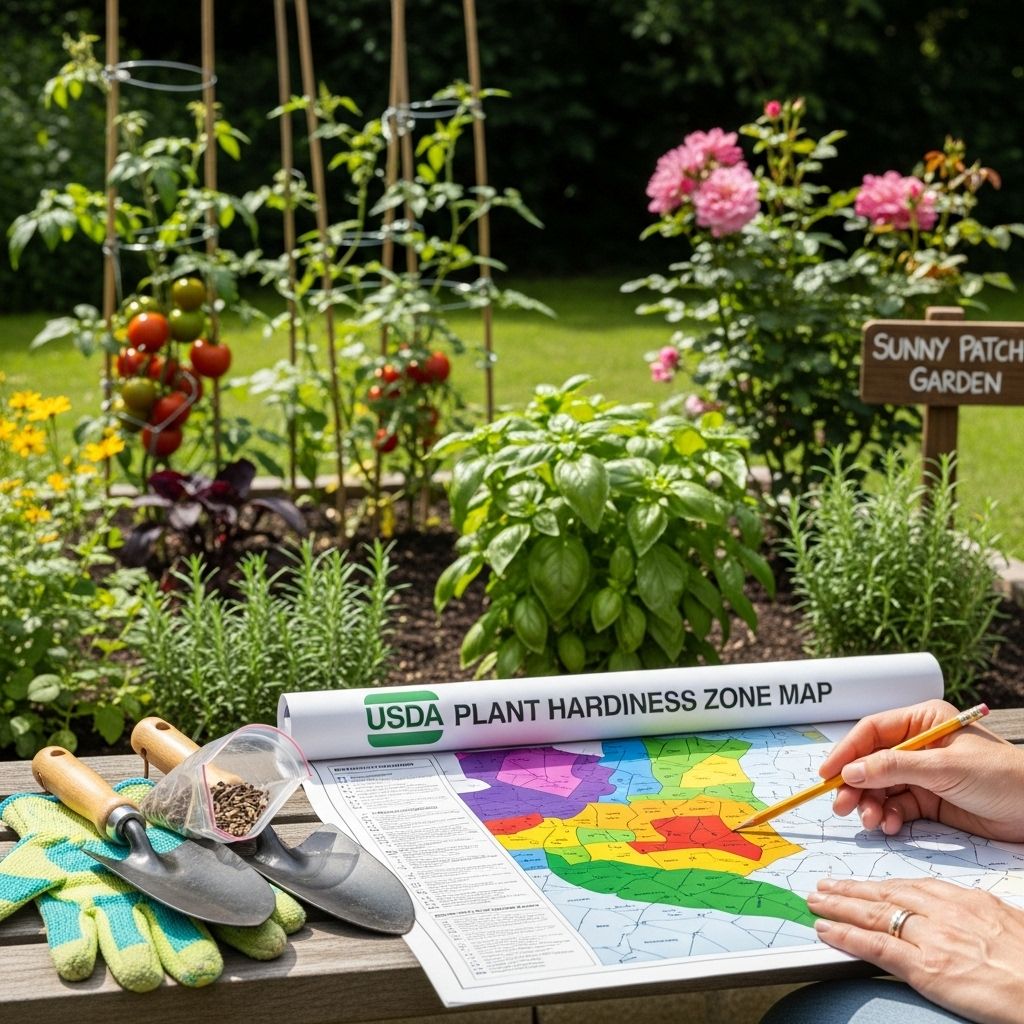
The USDA Planting Zone Map, also referred to as the Plant Hardiness Zone Map, is one of the most valuable tools for gardeners and growers across the United States. It provides a science-based approach to determining which perennial plants are likely to thrive in various locations, effectively taking the guesswork out of strong and resilient garden planning. This guide explores the logic behind the map, how to interpret its zones, how to use it for practical plant choices, and what its limitations are.
What is the USDA Planting Zone Map?
The USDA Plant Hardiness Zone Map is a detailed geographic representation of the United States, designed to show gardeners where specific perennial plants can be expected to thrive according to the annual minimum winter temperature in that region (USDA). It acts as a climate reference guide, providing essential data on how cold a garden can expect to get during the roughest winter stretches.
- The map divides the country into 13 distinct hardiness zones, each encompassing a 10-degree Fahrenheit (F) range of average annual minimum temperatures (Moon Valley Nurseries).
- Each zone is further broken into “a” and “b” half-zones, denoting 5-degree F increments for further precision (Gardening Know How).
- Zone 1 is assigned to the coldest regions, while Zone 13 designates the warmest (Arbor Day Foundation).
The zones are mapped throughout the United States and parts of Canada and Mexico, with the goal to assist gardeners, arborists, and farmers in choosing perennial plants suited to their local climates.
Understanding Hardiness Zones and How They Work
Hardiness zones are determined by averaging historical records of the annual extreme minimum temperatures for each area over a period of years. The lower the zone number, the colder the average minimum temperature. For example:
| Zone | Min Temp (°F) | Min Temp (°C) |
|---|---|---|
| 1a | -60 to -55 | -51.1 to -48.3 |
| 5b | -15 to -10 | -26.1 to -23.3 |
| 10a | 30 to 35 | -1.1 to 1.7 |
| 13b | 65 to 70 | 18.3 to 21.1 |
Plants that are perennial in one zone may not survive the winter in a colder zone unless provided with extra protection. If a plant is labeled as “hardy to zone 5,” for example, it can reliably handle temperatures down to -20°F.
Using the USDA Zone Map: Benefits and Best Practices
The USDA Zone Map makes gardening more successful by guiding you in picking plants that match your region’s lowest winter temperatures. Here’s how to put this resource to work:
- Check the label or plant description for the minimum hardiness zone; only choose plants that are recommended for your zone or lower.
- Look up your zip code or use interactive online USDA Zone Maps for a quick determination of your area’s assigned hardiness zone (USDA PHZ).
- Use zones as guidelines for perennial plants, trees, and shrubs; annuals are less dependent as they’re expected to survive only one season.
- If you’re planting at the boundary of two zones, selecting plants hardy to the colder zone provides an added margin of safety.
- Be aware of microclimates in your yard; variations in sunlight, wind exposure, elevation, or shelter can make some spots warmer or colder than the generalized zone suggests (Arbor Day Foundation).
Zone Map Details: How Zones Are Calculated
The current USDA Zone Map is built using climatic data records, typically spanning 30-year periods. Updates are periodically made to reflect climate shifts. The average extreme minimum temperature serves as the sole criteria for categorization. For example:
- Zone 3a minimums: -40 to -35°F (-40 to -37°C)
- Zone 7b minimums: 5 to 10°F (-15 to -12°C)
The map is available both in PDF and interactive digital format, often with search by zip code or by visual selection. The half-zone designations “a” and “b” add further granularity, improving plant selection accuracy for those near zone boundaries.
Why Plant Hardiness Matters
A plant’s “hardiness” is its ability to withstand cold temperatures. Without attention to plant hardiness, perennial plants can suffer winter injury or complete failure. The zone system allows you to:
- Reduce guesswork and avoid losses from planting non-hardy species.
- Confidently invest in trees and shrubs that will survive through cold snaps and variable winters.
- Design gardens with year-round structure by including perennials best adapted to local climate extremes.
- Enhance landscape sustainability by reducing the need for winter protection or frequent replanting.
Limitations and Important Considerations
While the map is an invaluable tool, it does have limitations. Not every plant’s survival depends solely on winter minimum temperatures:
- Other crucial factors: Summer heat, precipitation, humidity, wind, soil type, and drainage all affect plant survival.
Example: Western U.S. gardeners may need additional resources like the Sunset climate zones, which account for growing season length, rainfall patterns, and other variables (Gardening Know How). - Microclimates can be dramatically different from the broader region: Courtyards, urban heat islands, valleys, and slopes can alter local climates.
- The map is most applicable for perennials. Annuals and tender plants may be grown outside their hardiness zones if started at the proper time and protected from frost.
- Changes in climate can shift zone boundaries over time; new maps are released periodically to reflect this (Climate Central).
For example, two cities in Zone 6 might face very different summer heat, rainfall, or wind conditions, requiring careful selection considering more than just the zone number.
Other Hardiness and Climate Zone Systems
While the USDA system is standard in the United States, gardeners should be aware of other zoning systems used in certain circumstances or regions:
- Sunset Western Garden Zones: Used especially in the western US; incorporates many more climate variables (e.g., altitude, humidity, wind, length of growing season).
- American Horticultural Society (AHS) Heat Zones: Based on number of days above 86°F; complements cold hardiness with heat tolerance (Wikipedia).
- Royal Horticultural Society (RHS) Zones: Used in the UK, with slightly differing criteria.
Differentiating heat zones from hardiness zones is important when planting species sensitive to extreme summer temperatures. Most US plant tags reference USDA cold zones by default.
Finding Your Zone and Planning Your Garden
The most accurate way to find your zone is to consult the current USDA Plant Hardiness Zone Map using your home address or zip code via the USDA interactive website. Once you find your zone:
- Compile a list of perennials, shrubs, and trees suited to your zone or a colder one (for extra assurance).
- Consult your local cooperative extension, reputable nurseries, or master gardeners for plant recommendations for both landscape and vegetable gardens.
- Remember, it is often safer to assume that your garden’s microclimate might be slightly colder or warmer than the general zone map suggests. For marginal species, place them in a sheltered spot or use mulch and protection during severe cold.
Table: Example Zones and Suitable Plants
| Zone | Min Temp (°F) | Example Perennials |
|---|---|---|
| 3a | -40 to -35 | Daylily, Peony, Spruce |
| 5b | -15 to -10 | Hosta, Lilac, Boxwood |
| 8a | 10 to 15 | Camellia, Crape Myrtle, Agapanthus |
| 11a | 40 to 45 | Banana, Bougainvillea, Bird of Paradise |
Adapting to a Changing Climate
It is important to note that hardiness zones are not static; as the U.S. climate gradually warms, many locations are shifting to higher-numbered (warmer) zones. Research indicates that a majority of US cities have already experienced upward shifts in their planting zones in recent decades (Climate Central):
- Nearly 67% of analyzed US locations have already shifted to warmer planting zones from 1951-1980 to 1995-2024.
- This affects which species will survive winters, often expanding choices for some regions while making certain cold-loving species less viable.
- Continued shifts are likely—gardeners should consult the most updated USDA maps and consider projections in long-term landscape planning.
Factor in local weather trends and consult updated maps for major plantings.
Final Tips for Successful Gardening with the USDA Zone Map
- Always check the hardiness zone rating for any plant before purchase or planting.
- Experiment with microclimates—for example, place sensitive plants near heat-retaining walls in cold zones, or in cool, shady spots in hot climates.
- Don’t rely solely on the zone number. Factor in soil quality, drainage, and moisture needs.
- If in doubt, consult a local nursery or extension service—they have region-specific advice that takes local variables into account.
- Understand that gardening is part science, part art—trial and observation improve success over time.
Frequently Asked Questions (FAQs)
Q: What is the USDA Plant Hardiness Zone Map for?
A: The USDA Plant Hardiness Zone Map helps gardeners and growers determine which perennial plants are most likely to survive and thrive based on the average minimum winter temperatures for a given area.
Q: How do I find my USDA planting zone?
A: You can find your planting zone by using the USDA’s interactive online map and entering your zip code, or by consulting state and regional versions available from universities and arboretums.
Q: Does the USDA Zone Map account for things like rainfall and soil?
A: No. The map is based exclusively on average annual minimum winter temperatures. Other important variables—including rainfall, soil quality, wind, and summer heat—are not factored into zones.
Q: Are hardiness zones used internationally?
A: Yes, though other countries and regions often have their own systems, such as the UK’s RHS zones or Canada’s Plant Hardiness Map. The USDA system, however, is internationally recognized for its simplicity and breadth.
Q: Can my backyard have more than one hardiness zone?
A: While your yard will have a primary USDA zone assignment, microclimates—created by terrain, buildings, or water features—can make parts of your property warmer or colder than the regional zone, allowing you to experiment with diverse plant choices.
References
- https://www.moonvalleynurseries.com/planting-zones
- https://planthardiness.ars.usda.gov
- https://www.gardeningknowhow.com/planting-zones/what-do-hardiness-zones-mean.htm
- https://shop.arborday.org/nursery-zones
- https://en.wikipedia.org/wiki/Hardiness_zone
- https://www.climatecentral.org/climate-matters/warming-planting-zones-2025
- https://www.provenwinners.com/learn/usda-hardiness-zones/zone-map
Read full bio of Sneha Tete


