Greenland’s Mystery Island: The Quest for Earth’s Northernmost Land
Exploring the discovery, debate, and implications of Greenland’s ‘new’ northernmost island found in the Arctic.

Greenland’s New Northernmost Island: Discovery and Doubt
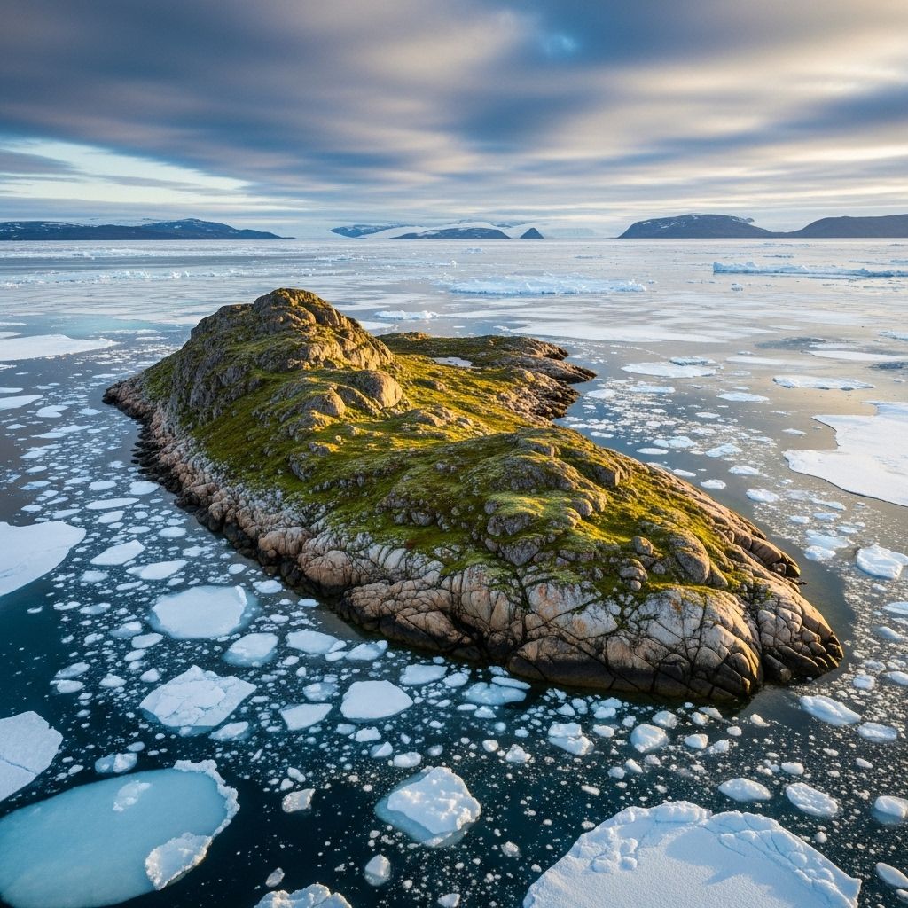
In August 2021, a team of researchers announced the discovery of what might be the world’s new northernmost island, located off the frigid northern coast of Greenland. The small, barren patch of land, provisionally named Qeqertaq Avannarleq—meaning “the northernmost island” in Greenlandic—was estimated at roughly 60 by 30 meters, rising just three to four meters above sea level, and covered only with sediment, mud, and debris from surrounding ice floes.
This announcement sparked excitement among geographers and climate scientists, as well as a flurry of controversy within the polar exploration community.
An Arctic Island Unlike Any Other
- Location: The island lies several hundred meters north of Greenland’s Cape Morris Jesup, the northernmost mainland point in the world.
- Physical Features: Qeqertaq Avannarleq lacks vegetation and has a surface composed of loose sediment, silt, and remnants from nearby ice sheets.
- Size: At discovery, estimates put the island at about 60 × 30 meters and three to four meters high.
Its emergence was notable largely because previous contenders for “northernmost island”—Kaffeklubben Island (Inuit Qeqertaat) and Oodaaq—are also located nearby, in this unstable region dominated by shifting ice and frequent climate extremes.
Provenance and Naming Controversy
The expedition team responsible for the find named it Qeqertaq Avannarleq. In the past, similar features—such as Oodaaq Island, discovered in 1978 by a Danish survey team—quickly grabbed attention before sometimes vanishing from maps, leading to debates about what truly constitutes an island in the ever-changing Arctic frontier.
Key Previous Discoveries
- Kaffeklubben Island (Inuit Qeqertaat): Located at 83º39’45”N, regarded as the prior northernmost piece of land. Size: 875 × 270 meters.
- Oodaaq Island: Discovered in 1978 (83º40’N), originally recognized as the northernmost island, but often disputed due to its fleeting appearance and later disappearance.
The region’s dynamic nature causes some islands to appear and vanish, with many features later revealed to be temporary gravel banks, icebergs, or piles of sediment stranded by the sea ice, rather than true islands.
Science Responds: Is It Truly an Island?
Following the announcement, a wave of scrutiny swept through the scientific community. Prolific northern Greenland explorer Dennis Schmitt and others voiced skepticism, noting that such discoveries are sometimes misleading: what looks like a “new island” may just be a transient accumulation of ice and sediment.
Bathymetric studies and helicopter reconnaissance in the area have demonstrated that many reported islets are not permanent landforms, but rather stranded icebergs or sediment deposits.
Scientific Findings
- Extensive surveys, including sonar, lidar, gravity measurements, and ice thickness assessments, have confirmed the non-existence of many reported islets, including Oodaaq Island and other contenders since 1978.
- Many features, though added to maps and used as baseline points for territorial waters, were later found submerged or moved, confirming their impermanence.
- The only broadly accepted permanent island north of Greenland remains Kaffeklubben Island (Inuit Qeqertaat), at latitude 83°39’54”N.
This means that while Qeqertaq Avannarleq may have temporarily taken the title of northernmost island, it is at risk of being erased from that status by the forces of shifting ice and Arctic storms.
Geopolitical Implications
Even temporary features such as Qeqertaq Avannarleq can have outsized importance for maritime boundaries and territorial claims.
- Exclusive Economic Zone (EEZ): If a new permanent land feature is confirmed, it could redefine Greenland’s—and thus Denmark’s—maritime boundaries, potentially extending sovereign rights over additional Arctic territory.
- Lomonosov Ridge: The island’s existence affects claims near the Lomonosov Ridge, an area disputed by Greenland/Denmark, Canada, and Russia as part of their continental shelf.
- Legal Status: Whether a feature is recognized as an island for EEZ purposes depends on its ability to remain above sea level indefinitely. The region’s instability complicates legal boundary claims.
The Arctic Environment: Change and Consequence
The ephemeral nature of these islands highlights rapid changes in the Arctic driven by climate change.
- July 2021 saw record rainfall over Greenland’s ice sheet, a clear sign of changing climate patterns with global implications.
- Accelerated ice sheet erosion is revealing new topographical features—and occasionally, new “islands.”
- These environmental changes prompt international concern over the fate of the world’s largest island and its role in regulating global sea level and climate.
While scientists caution that many so-called islands in the region are temporary, the processes driving their appearance and disappearance reflect deeper, more lasting changes in Arctic geomorphology and ecology.
Human Exploration: Adventure and Ambiguity
Since the early 20th century, polar explorers have been fascinated by the shifting limits of land in the high north. Danish explorer Lauge Koch visited Kaffeklubben Island in 1921, marking the start of territorial claims and boundary mapping that would endure for decades.
Modern expeditions continue to seek out new islands and features, driven by a mix of scientific curiosity, geopolitical urgency, and national pride.
Historic Expeditions
- 1978: Danish Geodetic Institute conducted modern geodetic surveys and discovered Oodaaq Island. It was added to Greenland’s maps and influenced boundary definitions.
- Leister Around North Greenland Expedition (2021): Swiss-Danish team reported the new island, Qeqertaq Avannarleq.
- 2022: Swiss-Danish follow-up expedition revisited and re-surveyed all past and current island positions, finding most had disappeared or moved.
Defining “Island” in the Arctic
The dispute around Qeqertaq Avannarleq illustrates how challenging it is to define “island” in the world’s frozen north.
| Feature | Description | Status |
|---|---|---|
| Kaffeklubben Island (Inuit Qeqertaat) | 875 × 270 meters, permanent sediment and moraine island | Accepted as world’s northernmost land |
| Oodaaq Island | c. 50 × 100 meters, gravel/sediment, appeared/disappeared | Disputed; found submerged/not permanent |
| Qeqertaq Avannarleq | c. 60 × 30 meters, mud/silt sediment, newly discovered | Transient; subject to confirmation |
The line between island, iceberg, and mere gravel bar is often blurred in the Arctic. Only features proven to persist above sea level over years and withstand shifting ice are deemed true islands.
Climate Change: Driving Geographical Instability
Changes in ice cover and weather in Greenland’s far north have not only produced record rainfall, but also threaten to erase or create new geographical features. In a context where islands can vanish after a single major storm or shifting ice pack, even mapmaking becomes an ephemeral task.
- Greenland’s ice sheet: Melting and rainfall are at unprecedented levels, revealing fresh sediment and creating short-lived landforms.
- Geomorphological processes: Erosion, deposition, and freezing work together, molding and remolding the landscape each year.
- Biodiversity impact: The land is so barren that no vegetation exists on these northern islets; their instability means little chance for life to establish.
International Implications and Arctic Sovereignty
The discovery—or disappearance—of northern islands can lead to international disputes over sovereignty in one of the planet’s last lawless frontiers.
- Contested territory: Canada, Russia, Greenland/Denmark all claim rights over the Lomonosov Ridge and adjacent areas, with each nation using scientific “island” discoveries to bolster legal arguments.
- EEZ extensions: A permanent, unambiguous land feature allows states to claim a wider Exclusive Economic Zone, granting access to fishing, minerals, and oil exploration.
- Geopolitical tension: Arctic boundary disputes are becoming increasingly common as melting ice opens new waterways and landforms.
Frequently Asked Questions (FAQs)
Q: What is the northernmost island in the world?
A: The permanent northernmost island recognized by scientists is Kaffeklubben Island (Inuit Qeqertaat), near northern Greenland.
Q: Why do new islands appear and disappear in the Arctic?
A: Arctic islands often emerge from temporary accumulations of sediment, ice, and glacier debris that can be eroded or submerged by shifting ice, storms, and rising temperatures.
Q: What does the discovery of a new northernmost island mean for Greenland?
A: If proven permanent, such discoveries may influence Greenland’s maritime boundaries and international claims; however, most features are temporary.
Q: How does climate change impact Arctic islands?
A: Rising temperatures and shrinking ice sheets cause rapid geographical changes, erosion, and the periodic appearance of new landforms.
Q: Who decides if a patch of land is a real island?
A: Scientific surveys—using bathymetric mapping and long-term observation—determine if features persist above sea level long enough to qualify as islands.
Conclusion: A World in Flux
The saga of Qeqertaq Avannarleq encapsulates the uncertainty and fascination at the heart of Arctic exploration. The northern frontiers are in constant motion, shaped and reshaped by ice, climate, and international intrigue. Whether Greenland’s “new” northernmost island persists or disappears, its story illustrates the challenge—and adventure—of understanding one of the planet’s most fragile and dynamic landscapes.
References
- https://overthecircle.com/2021/09/12/its-all-about-geography-a-new-island-is-found-off-greenland%EF%BF%BC/
- https://explorersweb.com/who-really-discovered-the-worlds-northernmost-island/
- https://orbit.dtu.dk/en/publications/northernmost-land-in-the-world-re-confirmed-islands-north-of-gree
- https://resolve.cambridge.org/core/journals/polar-record/article/northernmost-land-in-the-world-reconfirmed-islands-north-of-greenland-are-icebergs/6A664C28459FEB983374DAC67F765846
- https://en.wikipedia.org/wiki/Kaffeklubben_Island
Read full bio of medha deb


