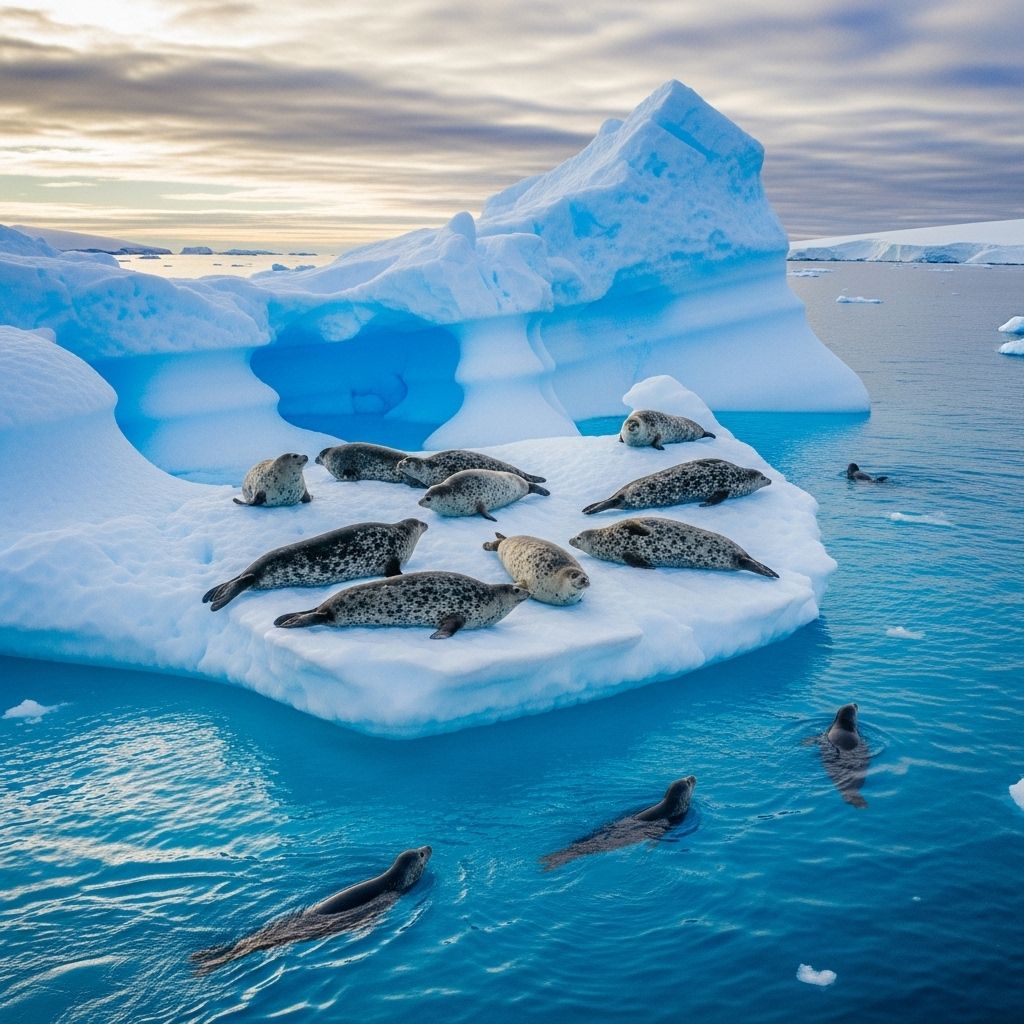
Antarctica’s First Weddell Seal Census Illuminates Ocean Health
A groundbreaking satellite-based census reveals the importance of Weddell seals as indicators of climate-driven change in Antarctica's fragile ecosystem.

For the first time in scientific history, researchers have achieved a comprehensive census of Weddell seals across Antarctica, dramatically enhancing our understanding of one of the continent’s most iconic and mysterious species. Harnessing the power of satellite imagery and global citizen science, this pioneering effort not only offers vital population benchmarks but also opens new windows into the future resilience of the Southern Ocean ecosystem amidst climate change.
Why Counting Weddell Seals Matters
Weddell seals (Leptonychotes weddellii) occupy a unique ecological niche, thriving on Antarctic fast ice and depending on the stability of this habitat for survival. They are particularly valuable in global conservation and climate research because:
- Indicator Species: Their health and numbers reflect the broader health of the Southern Ocean ecosystem, making them sentinel species for shifts induced by environmental change.
- Ecological Role: They are apex predators, feeding primarily on Antarctic toothfish, which are also targets of commercial fisheries.
- Habitat Dependence: Their breeding success and survival are closely tied to the persistence of stable sea ice, now under threat as temperatures climb.
Understanding Weddell seal populations is crucial for monitoring the impacts of fishing, environmental shifts, and conservation measures across one of the world’s most remote frontiers.
The Enormous Challenge of Counting Seals in Antarctica
Traditional wildlife census methods—such as direct field counts—present severe limitations in Antarctica, where vast distances, harsh weather, and logistical constraints rule:
- Many fast ice regions, critical for seals, are inhospitable and often inaccessible even to researchers.
- Previous population estimates relied heavily on single regions, notably Erebus Bay, lacking continent-wide perspective.
- Inconsistent data hindered understanding of how diverse environmental factors shape seal distribution.
To address these gaps, scientists have adopted cutting-edge technologies and collaborative methodologies, ushering in a new era for Antarctic ecological research.
Innovative Science: Satellite Imagery and Citizen Scientists Unite
The new census marks a breakthrough by combining high-resolution satellite imagery with the collective power of citizen science:
- Satellites: Modern satellites can cover Antarctica’s vast, remote, and persistent sea ice regions efficiently, using images that reveal the seals’ dark bodies contrasted against white ice.
- Global Volunteers: Through platforms like Tomnod (and similar projects), thousands of volunteers examined individual images, helping experts pinpoint and tally seal haul-outs on fast ice across thousands of kilometers.
- Validation: Computer models and expert verification helped filter errors and refine the final numbers—a pioneering use of crowdsourced data for wildlife monitoring at this scale.
This collaborative approach not only vastly increased the count’s reach and accuracy, but it also fostered public engagement with Antarctic science.
Key Findings: The Population of Weddell Seals
From this exhaustive effort, the initial census produced a robust estimate of the planet’s Weddell seal population:
- Nearly 202,000 adult Weddell seals were detected across the Antarctic coastline.
- The highest densities were recorded in the Ross Sea Region—particularly notable as this area supports both rich fast ice environments and the world’s largest marine protected area (MPA).
- Lower densities or absence of seals were found in regions with unstable or declining sea ice.
This unprecedented dataset immediately becomes a reference point for future studies and conservation strategies.
The Ross Sea: A Sanctuary and a Stronghold
One of the most revealing outcomes was the identification of the Ross Sea as a critical habitat for Weddell seals:
- This region contains approximately one-third of the world’s known Weddell seal population, emphasizing its global importance.
- The Marine Protected Area designation underscores the role of the Ross Sea as a living laboratory for studying predator and prey dynamics, environmental change, and the efficacy of large-scale conservation.
Continuous monitoring here is essential for measuring both the health of local populations and the effectiveness of protection measures.
Ecological Role and Foraging Behavior of Weddell Seals
Weddell seals are deeply intertwined with the rhythms of the Antarctic ecosystem:
- They primarily prey on Antarctic toothfish and a variety of fish and invertebrates.
- Foraging success is closely linked to oceanographic conditions, including the availability of modified shelf and ice shelf water, which provide richer feeding grounds.
- Seals demonstrate remarkable adaptability, with recent studies showing relaxed foraging patterns in response to changing prey distributions and ice conditions.
The seals’ feeding and breeding behavior offer scientists a dynamic measure of ecosystem changes and provide early warnings of environmental stress.
Climate Change: The Biggest Threat to Weddell Seals
One of the major driving forces shaping Weddell seal futures is warming-induced sea ice loss:
- Stable, predictable fast ice is essential for pupping and resting. Early melt, thinning, or fragmentation can devastate colonies.
- Long-term monitoring has linked substantial local and regional declines in seal numbers to unpredictable ice cover, particularly in sub-Antarctic islands.
- The Ross Sea remains a relative stronghold, but scientists caution that even there, continued warming may erode essential habitat.
Seals serve as a “canary in the coal mine” for the repercussions of unchecked climate warming on Antarctic wildlife.
Conservation and the Future of Weddell Seals
The census lays critical groundwork for conservation and management efforts throughout the waters of the Southern Ocean:
- Monitoring: Systematic use of satellite imagery and citizen involvement can track population shifts in real time across decades.
- Protected Areas: Findings reinforce the value of existing MPAs and call for expanded protections in vulnerable hotspots.
- Policy: Data can inform international fisheries management, minimizing conflicts with predator species and safeguarding food webs.
Research partnerships, including NASA-supported work, are now leveraging these insights to study broader predator-prey dynamics and the resilience of Antarctic life under accelerating environmental changes.
Methods: How the Census Was Conducted
The landmark Weddell seal count relied on a novel blend of modern technology and mass collaboration:
- High-resolution satellite images were systematically analyzed, covering nearly all persistent fast ice regions during the breeding season.
- More than 300,000 individual annotations by volunteers were filtered and aggregated using robust algorithms and expert oversight.
- Validation checks and comparisons to known tagged populations in regions like Erebus Bay confirmed the method’s reliability, with error rates far lower than would be possible through field observation alone.
This method now serves as a template for other hard-to-reach or wide-ranging wildlife species the world over.
Comparison Table: Traditional Vs. Satellite Citizen Science Census
| Aspect | Traditional Field Survey | Satellite & Citizen Science Census |
|---|---|---|
| Coverage | Limited to accessible areas, often small geographic scale | Comprehensive, continent-wide coverage of fast ice habitats |
| Logistics | High cost, harsh fieldwork, safety risks | Cost-effective, utilizes commercial/public satellite assets, remote processing |
| Repeatability | Infrequent due to resources and logistics | Highly repeatable, scalable with volunteer effort |
| Public Engagement | Minimal | High; thousands of global volunteers |
| Accuracy | Subject to observer bias, weather/visibility | Validated statistically, consistent methodology |
The Vital Role of Citizen Science in Antarctic Research
Citizen science was not just an innovation in labor; it became an integral part of how Antarctic science can operate in the 21st century:
- Empowered individuals worldwide to directly contribute to meaningful ecological research.
- Increased scientific transparency and engagement, fostering a sense of stewardship for distant environments.
- Demonstrated that “many eyes” can often outperform small teams of experts in data annotation for large image datasets when paired with proper validation.
This approach represents a scalable model for tracking biodiversity not only in Antarctica but in other inaccessible and sensitive regions.
Outstanding Questions and Future Directions
While the census represents an enormous leap forward, the study of Weddell seals faces continued challenges and crucial open questions:
- What is the detailed genetic connectivity among colonies separated by hundreds or thousands of kilometers of ice?
- How will rapidly changing sea ice and ocean conditions drive long-term population trends?
- To what extent will human impacts, such as increased fisheries activity and tourism, intersect with climate-driven change?
Ongoing research will need to combine genetics, advanced oceanographic data, and repeated satellite-based counts to develop robust predictive models and conservation responses.
Frequently Asked Questions (FAQs)
Q: Why are Weddell seals important to study?
A: Weddell seals serve as ecological indicators of the Southern Ocean’s health, reflecting changes in sea ice, prey availability, and broader ecosystem dynamics.
Q: How do scientists count seals from space?
A: They use high-resolution satellite images to locate dark-bodied seals on bright fast ice, with human volunteers helping to identify and count individuals in each image.
Q: What are the major threats to Weddell seals?
A: The biggest threats are loss of stable sea ice due to climate warming and potential competition or disruption from fishing activities targeting shared prey species.
Q: Can citizen science really produce reliable data?
A: Yes. Carefully designed projects combine many independent observations, error filtering, and expert review to produce robust and scientifically valid data, as shown in this census.
Q: Will this census be repeated?
A: Plans are underway to make satellite-based censuses regular, tracking population trends, and measuring responses to environmental and policy changes over time.
Conclusion: A New Era for Antarctic Monitoring
The first continent-wide Weddell seal count is far more than a scientific milestone—it is a beacon for future conservation, global collaboration, and the power of new technologies combined with human curiosity. As the challenges of climate change and conservation intensify, these seals’ fates will remain tightly bound to the fate of Antarctica itself—and by extension, the planet as a whole.
References
- https://phys.org/news/2025-06-sea-ice-future.html
- https://www.antarcticscienceplatform.org.nz/research/opportunity-projects/weddell-seals-in-the-ross-sea
- https://www.usap.gov/sciencesupport/scienceplanningsummaries/2023_2024/results.cfm?formAction=detail&ID=2761
- https://egusphere.copernicus.org/preprints/2024/egusphere-2023-2757/
- https://inmotion.typepad.com/weddell_seal_science/2023/10/
- https://www.threads.com/@britishantarcticsurvey/post/DLDLs13tWqC/while-there-was-no-significant-overall-decline-in-southern-elephant-seal-numbers
- https://www.fisheries.noaa.gov/west-coast/population-assessments/cape-shirreff-situation-reports-2023-2024
- https://pmc.ncbi.nlm.nih.gov/articles/PMC12175055/
- https://inmotion.typepad.com/weddell_seal_science/
Read full bio of Sneha Tete


