El Niño vs. La Niña: How Pacific Oscillations Shape Global Weather
Understanding the opposing Pacific phenomena that drive dramatic shifts in weather around the globe.

El Niño vs. La Niña: Understanding Earth’s Most Influential Climate Patterns
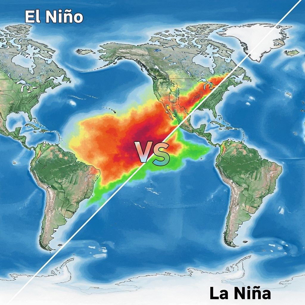
El Niño and La Niña are two powerful phases of the El Niño-Southern Oscillation (ENSO), a cyclical phenomenon in the tropical Pacific Ocean. They play a pivotal role in controlling weather, climate, and oceanic conditions across the planet. Despite being opposite in nature, both events significantly impact ecosystems, agriculture, economies, and communities worldwide.
What Are El Niño and La Niña?
ENSO refers to the constant fluctuation — between warm and cool phases — of sea surface temperatures, trade winds, and atmospheric pressure in the central and eastern tropical Pacific Ocean. Its two most recognized expressions are:
- El Niño: The warm phase, marked by higher than normal sea surface temperatures in the eastern and central Pacific.
- La Niña: The cool phase, characterized by lower than normal sea surface temperatures in the same region.
Both phases trigger lasting changes in atmospheric circulation, leading to far-reaching consequences for weather and climate globally.
The Science Behind ENSO: How Do El Niño and La Niña Occur?
Normal (Neutral) Pacific Conditions
In a typical, neutral year:
- Strong easterly trade winds push warm surface waters toward the western Pacific, piling up heated waters near Asia.
- The eastern Pacific near South America experiences upwelling — the rise of cold, nutrient-rich waters from the deep ocean — supporting abundant marine life.
- Rainfall is mainly concentrated in the warm waters of the western Pacific; the Americas experience cooler, drier conditions.
El Niño: The Warm Phase
El Niño forms when:
- Trade winds weaken or reverse, allowing warm water to shift eastward across the Pacific.
- This movement suppresses upwelling in the eastern Pacific, raising sea surface temperatures and disrupting nutrient cycles.
- The increased warmth redistributes rainfall, energy, and atmospheric circulation patterns well beyond the Pacific basin.
La Niña: The Cool Phase
La Niña represents the opposite extreme:
- Trade winds strengthen, further pushing warm water to the far western Pacific.
- More intense upwelling brings cooler, nutrient-rich water to the surface off South America.
- Rainfall shifts even further west; the Americas become cooler and drier, while Asia and Oceania may see abnormal wetness and storms.
Key Differences Between El Niño and La Niña
| Feature | El Niño | La Niña |
|---|---|---|
| Sea Surface Temperatures | Warmer than average in eastern Pacific | Cooler than average in eastern Pacific |
| Trade Winds | Weaken or reverse | Strengthen above normal |
| Upwelling | Weakens, nutrient-poor water | Strengthens, nutrient-rich water |
| Rainfall (Eastern Pacific) | Increases; risk of flooding | Decreases; risk of drought |
| Rainfall (Western Pacific) | Decreases; risk of drought | Increases; risk of floods |
| Atlantic Hurricanes | Decreases (suppressed by wind shear) | Increases (less wind shear) |
| US Winter Effects | Wetter South, milder North | Wetter Northwest, drier South |
How El Niño and La Niña Affect Global Weather Patterns
Worldwide Climate Impacts
- El Niño:
- Flooding risks rise in coastal South America, with heavy rains and landslides.
- Drought and wildfire become more likely in Australia, Southeast Asia, and parts of Africa.
- Weakened monsoons can hurt agriculture across Asia and India.
- Fisheries off Peru and Ecuador suffer when upwelling slows, reducing nutrient availability and collapsing fish stocks.
- Atlantic hurricane activity typically declines due to more disruptive high-altitude winds (increased wind shear).
- La Niña:
- Heavier rainfall and increased flood risk for Southeast Asia, Australia, and Indonesia.
- Drier, drought-like conditions in Peru, Ecuador, and western South America.
- Amplifies Atlantic hurricane activity (less wind shear).
- Better conditions for fisheries off South America due to an abundance of nutrients from enhanced upwelling.
- Colder winters in regions such as northern North America and wetter winters along the Pacific Northwest.
Impact on the United States
- El Niño:
- Wetter, stormier conditions in the southern states (California, Texas, Florida).
- Milder, drier winter in northern regions, including the Pacific Northwest and Midwest.
- Increased risk of flooding, landslides, and above-average precipitation overall in southern tier.
- Reduced number and strength of Atlantic hurricanes.
- La Niña:
- Cooler, wetter conditions in the Pacific Northwest, Great Lakes, and northern U.S., leading to harsher winters and more snowfall.
- Drier, warmer conditions across the southern states.
- Increased risk of drought and heat waves in Southwest and parts of the South.
- Atlantic hurricane season tends to be more active and intense.
Ecological and Environmental Impacts
Beyond altering weather, ENSO events have profound effects on ecosystems and biodiversity:
- Coral Reefs: Elevated temperatures during El Niño can cause coral bleaching — a stress response that makes reefs vulnerable to disease and death.
- Fisheries: Marine food webs off Peru and Ecuador are disrupted during El Niño when upwelling halts, affecting fish, birds, and marine mammals dependent on the ecosystem.
- Agriculture: Droughts, floods, or altered monsoons threaten crop yields, food security, and local economies globally during extreme ENSO events.
- Wildfire Risk: Hot, dry conditions spurred by El Niño in regions like Australia or the Amazon can fuel widespread wildfires, biodiversity loss, and air quality hazards.
ENSO Neutral: When Conditions Are Average
Not every year swings to an El Niño or La Niña episode. ENSO-neutral years — when sea surface temperatures and atmospheric patterns are close to average — usually bring more typical seasonal weather for most regions. However, “neutral” does not mean absence of all climate risk, since local factors and other climate oscillations may still bring disruptions.
Predicting and Preparing for ENSO Events
Long-term data collection using ocean buoys, satellites, and advanced climate models now allow meteorologists and climatologists to forecast ENSO shifts months in advance. Early warnings help communities, governments, and farmers brace for extremes such as droughts, floods, poor harvests, or active storm seasons. Still, not all effects can be accurately predicted, and ENSO remains one of the most challenging natural phenomena for climate science to forecast precisely.
- Monitoring Systems: Networks like NOAA’s El Niño/Southern Oscillation Observation System track oceanic and atmospheric signals to provide updates and outlooks.
- Preparedness: Knowledge of ENSO trends can guide disaster response, infrastructure resilience, and agricultural planning on regional and global scales.
ENSO and a Changing Climate
Researchers continue to study how global warming might influence the frequency, intensity, and impacts of ENSO events. Some models forecast that El Niño and La Niña cycles may become more intense, leading to even larger disruptions, while others suggest changing baseline climate conditions could alter the regions most affected. Monitoring ENSO events is therefore critical for understanding Earth’s climate future.
Frequently Asked Questions (FAQs)
Q: What exactly is the El Niño–Southern Oscillation (ENSO) cycle?
A: ENSO is a recurring climate pattern involving changes in the temperature of waters in the central and eastern tropical Pacific Ocean. It oscillates between El Niño (warm phase), La Niña (cool phase), and neutral conditions.
Q: How often do El Niño and La Niña events occur?
A: Both events typically occur every two to seven years, lasting from several months up to a year or more, though the strength and effects vary from one cycle to another.
Q: Can El Niño or La Niña be predicted in advance?
A: Meteorologists use oceanic and atmospheric data, along with computer models, to sometimes predict ENSO events up to a season ahead. Forecast accuracy declines further into the future.
Q: Why do El Niño and La Niña have such a big impact on the weather in the United States?
A: Because the Pacific Ocean covers a third of the planet and ENSO alters heat and moisture distribution, these events can shift the position of the jet stream, a key factor in controlling North American weather.
Q: Are there ways individuals and communities can prepare for ENSO impacts?
A: Yes. Staying informed about forecasts, supporting resilient infrastructure development, and planning for possible droughts, storms, or floods can all reduce ENSO’s negative effects.
References and Further Reading
- National Oceanic and Atmospheric Administration (NOAA) – ENSO Resources
- United States Geological Survey (USGS) – El Niño and La Niña Impacts
- Intergovernmental Panel on Climate Change (IPCC) – Climate Change and ENSO
- Peer-reviewed climate science journals
References
- https://www.albert.io/blog/el-nino-and-la-nina-ap-environmental-science-review/
- https://www.maximum-inc.com/learning-center/el-nino-vs-la-nina-what-is-the-difference-and-how-do-they-impact-on-u-s-weather/
- https://www.kgun9.com/weather/monsoon/whats-the-difference-between-el-nino-and-la-nina
- https://www.neefusa.org/story/climate-change/el-nino-and-la-nina-whats-difference
- https://oceanservice.noaa.gov/facts/ninonina.html
- https://www.climate.gov/news-features/understanding-climate/el-nino-and-la-nina-frequently-asked-questions
- https://psl.noaa.gov/enso/enso.different.html
- https://earthhow.com/el-nino-la-nina/
- https://www.tidalbasingroup.com/what-is-the-difference-between-la-nina-and-el-nino/
Read full bio of medha deb


